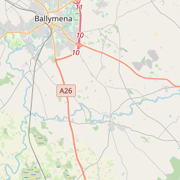
Based on data in OpenStreetMap, here is a list of townlands in the Electoral Division / ED / District Electoral Division of Antrim Rural.
Antrim Rural is in Co.
Antrim Rural is not matched up to Logainm.ie yet.
Map
It is located at 54° 43' 0" N, 6° 11' 39" W.


Leaflet | Map data © OpenStreetMap contributors
Area
Antrim Rural has an area of 34.7 km² / 8,585.2 acres / 13.4 square miles.
Townlands
There are 34 townlands that we know about in . This represents 81.2% of all the area in .
- Ballyarnot 321 A, 3 R, 16 P
- Ballycraigy 222 A, 3 R, 6 P
- Ballyharvey Lower 223 A, 1 R, 33 P
- Ballyharvey Upper 158 A, 2 R, 11 P
- Birch Hill 98 A, 1 R, 30 P
- Bleerick 59 A, 3 R, 30 P
- Brettens Walls 48 A, 2 R, 30 P
- Bush 185 A, 3 R, 35 P
- Caulside 69 A, 0 R, 18 P
- Craigy Hall 100 A, 2 R, 8 P
- Crosskennan 409 A, 0 R, 18 P
- Farranshane 115 A, 1 R, 17 P
- Gally Hill 131 A, 2 R, 39 P
- Glenmullion 75 A, 1 R, 20 P
- Holy Well 97 A, 3 R, 9 P
- Hungry Hall 69 A, 2 R, 32 P
- Hurtletoot 162 A, 3 R, 7 P
- Irishtown 150 A, 3 R, 17 P
- Islandbane 270 A, 0 R, 3 P
- Ladyhill 780 A, 1 R, 21 P
- Moylinney 132 A, 1 R, 15 P
- Muckamore 378 A, 0 R, 12 P
- Newpark 80 A, 1 R, 27 P
- Niblock 320 A, 0 R, 9 P
- Oldstone 407 A, 3 R, 37 P
- Park Hall 130 A, 1 R, 36 P
- Potterswalls 174 A, 0 R, 21 P
- Rathenraw 91 A, 3 R, 18 P
- Shaneoguestown 526 A, 1 R, 16 P
- Spring Farm 99 A, 3 R, 28 P
- Steeple 191 A, 2 R, 12 P
- Stiles 89 A, 2 R, 39 P
- Tirgracey 461 A, 0 R, 36 P
- Whin Park 134 A, 2 R, 3 P
 OpenStreetMap
Antrim Rural was added to OpenStreetMap on 26 Feb 2021 by b-unicycling.
- View
- Edit

 JOSM
JOSM iD
iD