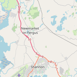
Based on data in OpenStreetMap, here is a list of townlands in the Electoral Division / ED / District Electoral Division of Clenagh.
Clenagh is in Co.
Clenagh is not matched up to Logainm.ie yet.
Map
It is located at 52° 42' 8" N, 8° 55' 40" W.


Leaflet | Map data © OpenStreetMap contributors
Area
Clenagh has an area of 60.0 km² / 14,830.0 acres / 23.2 square miles.
Townlands
There are 30 townlands that we know about in . This represents 51.1% of all the area in .
- Ballinooskny 98 A, 2 R, 35 P
- Ballycally 519 A, 2 R, 28 P
- Ballycasey Beg 117 A, 1 R, 29 P
- Ballycasey More 375 A, 1 R, 24 P
- Ballyhennessy 219 A, 1 R, 0 P
- Ballymacnevin 91 A, 0 R, 39 P
- Ballymurtagh 76 A, 1 R, 19 P
- Caherteige 401 A, 2 R, 4 P
- Carrigerry 159 A, 2 R, 15 P
- Carrow 125 A, 2 R, 0 P
- Carrowbane 169 A, 0 R, 4 P
- Clenagh 735 A, 1 R, 23 P
- Clonloghan 400 A, 3 R, 6 P
- Deenish Island 27 A, 3 R, 3 P
- Drumgeely 223 A, 3 R, 25 P
- Feenish 177 A, 0 R, 13 P
- Fergus Island 0 A, 3 R, 34 P
- Garrynamona 174 A, 1 R, 11 P
- Inishmacnaghtan 283 A, 2 R, 14 P
- Knockaun 142 A, 2 R, 25 P
- Knockaun 119 A, 3 R, 38 P
- Lisconor 104 A, 0 R, 0 P
- Lismacleane 111 A, 0 R, 3 P
- Rineanna North 606 A, 2 R, 20 P
- Rineanna South 690 A, 0 R, 5 P
- Smithstown 304 A, 1 R, 39 P
- Stonehall 329 A, 3 R, 15 P
- Tullyglass 295 A, 2 R, 26 P
- Tullyvarraga 260 A, 1 R, 6 P
- Tullyvarraga 230 A, 3 R, 39 P
 OpenStreetMap
Clenagh was added to OpenStreetMap on 18 Dec 2016 by Teester.
- View
- Edit

 JOSM
JOSM iD
iD