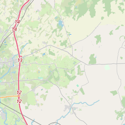
Based on data in OpenStreetMap, here is a list of townlands in the Electoral Division / ED / District Electoral Division of Crusheen.
Crusheen is in Co.
Crusheen is not matched up to Logainm.ie yet.
Map
It is located at 52° 56' 46" N, 8° 53' 47" W.


Leaflet | Map data © OpenStreetMap contributors
Area
Crusheen has an area of 28.9 km² / 7,138.0 acres / 11.2 square miles.
Townlands
There are 28 townlands that we know about in . This represents 100% of all the area in .
- Ballygassan 198 A, 1 R, 16 P
- Ballyline 477 A, 1 R, 23 P
- Ballyvanna 268 A, 2 R, 39 P
- Caheraphuca 305 A, 1 R, 29 P
- Cappamore 192 A, 3 R, 35 P
- Cappanapeasta 804 A, 3 R, 25 P
- Carrahil 201 A, 2 R, 5 P
- Carrowkeel Beg 104 A, 0 R, 28 P
- Carrowkeel More 198 A, 3 R, 31 P
- Carrownacloghy 299 A, 1 R, 15 P
- Cloonagowan 118 A, 2 R, 35 P
- Clooneen 360 A, 3 R, 28 P
- Cloonmoney 74 A, 2 R, 7 P
- Crusheen 86 A, 1 R, 36 P
- Cullenagh 89 A, 0 R, 6 P
- Derrynagarriff 348 A, 0 R, 19 P
- Derrynagleragh 73 A, 2 R, 39 P
- Drummanneen 258 A, 0 R, 23 P
- Drumminacknew 261 A, 2 R, 28 P
- Drumsallagh 95 A, 3 R, 37 P
- Drumumna 489 A, 0 R, 4 P
- Gortaficka 301 A, 0 R, 16 P
- Gortanuska 303 A, 1 R, 25 P
- Gortlurkaun 87 A, 3 R, 1 P
- Inchicronan Island 185 A, 2 R, 3 P
- Knockmael West 208 A, 1 R, 3 P
- Lahardan 281 A, 1 R, 23 P
- Sranagalloon 462 A, 1 R, 12 P
 OpenStreetMap
Crusheen was added to OpenStreetMap on 17 Dec 2016 by Teester.
- View
- Edit

 JOSM
JOSM iD
iD