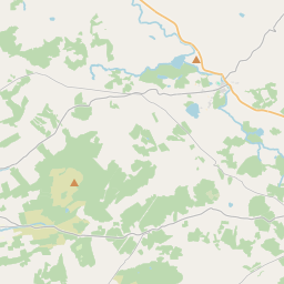
Based on data in OpenStreetMap, here is a list of townlands in the Electoral Division / ED / District Electoral Division of Killinaboy.
Killinaboy is in Co.
Killinaboy is not matched up to Logainm.ie yet.
Map
It is located at 52° 59' 1" N, 9° 6' 50" W.


Leaflet | Map data © OpenStreetMap contributors
Area
Killinaboy has an area of 31.3 km² / 7,730.8 acres / 12.1 square miles.
Townlands
There are 24 townlands that we know about in . This represents 100% of all the area in .
- Ballycasheen 334 A, 2 R, 26 P
- Ballyganner South 580 A, 0 R, 13 P
- Ballyline 136 A, 2 R, 8 P
- Boultiaghadine 301 A, 1 R, 1 P
- Bunnanagat North 25 A, 3 R, 3 P
- Bunnanagat South 124 A, 2 R, 22 P
- Caherblonick North 296 A, 3 R, 27 P
- Caherblonick South 192 A, 0 R, 31 P
- Caherfadda 432 A, 0 R, 3 P
- Cahermacon 140 A, 1 R, 0 P
- Clooneen 483 A, 0 R, 5 P
- Commons North 426 A, 1 R, 12 P
- Commons South 634 A, 3 R, 16 P
- Deerpark 166 A, 1 R, 15 P
- Drummoher 466 A, 0 R, 10 P
- Elmvale 113 A, 0 R, 35 P
- Killinaboy 160 A, 1 R, 16 P
- Leamanee North 377 A, 0 R, 21 P
- Leamanee South 187 A, 3 R, 2 P
- Leana 669 A, 2 R, 31 P
- Monanaleen 287 A, 0 R, 4 P
- Parknabinnia 362 A, 2 R, 38 P
- Roughaun 118 A, 0 R, 11 P
- Sheshymore 713 A, 3 R, 8 P
 OpenStreetMap
Killinaboy was added to OpenStreetMap on 17 Dec 2016 by Teester.
- View
- Edit

 JOSM
JOSM iD
iD