Based on data in OpenStreetMap, here is a list of townlands in the Electoral Division / ED / District Electoral Division of Newtown.
Newtown is in Co.
Newtown is not matched up to Logainm.ie yet.
Map
It is located at 52° 21' 34" N, 8° 46' 56" W.
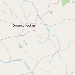
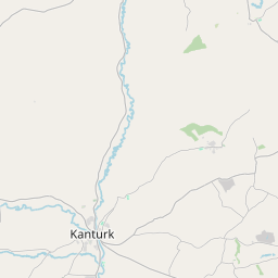
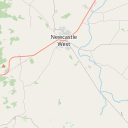
Leaflet | Map data © OpenStreetMap contributors
Area
Newtown has an area of 25.5 km² / 6,299.8 acres / 9.8 square miles.
Townlands
There are 14 townlands that we know about in . This represents 100% of all the area in .
- Ballynakilla East 890 A, 0 R, 11 P
- Ballynakilla West 627 A, 3 R, 32 P
- Cloonleagh North 305 A, 3 R, 8 P
- Cloonleagh South 266 A, 3 R, 29 P
- Cloonmore 431 A, 0 R, 15 P
- Coolasmuttane 705 A, 3 R, 30 P
- Kilmagoura 330 A, 0 R, 26 P
- Maine North 815 A, 0 R, 36 P
- Maine South 493 A, 1 R, 22 P
- Maunabricka 306 A, 1 R, 23 P
- Newtown North 227 A, 2 R, 14 P
- Newtown South 228 A, 2 R, 15 P
- Rusheen 436 A, 3 R, 18 P
- Shinanagh 233 A, 3 R, 2 P
 OpenStreetMap
Newtown was added to OpenStreetMap on 26 Jan 2017 by Teester.
- View
- Edit