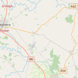
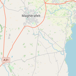
Based on data in OpenStreetMap, here is a list of townlands in Ballyscullion.
Ballyscullion ist in den Baronien Loughinsholin und Toome Upper.
Ballyscullion ist in den Grafschaften Antrim und Londonderry.
Ballyscullion is not matched up to Logainm.ie yet.
Karte
Befindet sich bei 54° 48' 45" N, 6° 30' 23" W.


Leaflet | Map data © OpenStreetMap contributors
Fläche
Ballyscullion hat eine Fläche von 42,4 km² / 10,474,3 Acres / 16,4 Quadratmeilen.
Townlands
There are 23 townlands that we know about in Ballyscullion. This represents 100% of all the area in Ballyscullion.
- Ballyscullion East, Gemeinde Ballyscullion, Baronie Toome Upper, Grafschaft Antrim 1058 A, 1 R, 28 P
- East Ballyscullion (see Ballyscullion East, Gemeinde Ballyscullion, Baronie Toome Upper, Grafschaft Antrim)
- amhnach Uí Fhuradhráin (see Tamniaran (amhnach Uí Fhuradhráin) , Gemeinde Ballyscullion, Baronie Loughinsholin, Grafschaft Londonderry)
- Ballydermot, Gemeinde Ballyscullion, Baronie Loughinsholin, Grafschaft Londonderry 469 A, 1 R, 4 P
- Ballymacombs More, Gemeinde Ballyscullion, Baronie Loughinsholin, Grafschaft Londonderry 1054 A, 0 R, 3 P
- Ballymacombs-Beg, Gemeinde Ballyscullion, Baronie Loughinsholin, Grafschaft Londonderry 657 A, 3 R, 4 P
- Ballynease-Helton, Gemeinde Ballyscullion, Baronie Loughinsholin, Grafschaft Londonderry 385 A, 2 R, 10 P
- Ballynease-Macpeake, Gemeinde Ballyscullion, Baronie Loughinsholin, Grafschaft Londonderry 779 A, 2 R, 14 P
- Ballynease-Strain, Gemeinde Ballyscullion, Baronie Loughinsholin, Grafschaft Londonderry 399 A, 1 R, 4 P
- Ballyscullion West, Gemeinde Ballyscullion, Baronie Loughinsholin, Grafschaft Londonderry 1106 A, 2 R, 5 P
- Coill-Ui-Bhearraigh (see Killyberry Downing (Coill-Ui-Bhearraigh) , Gemeinde Ballyscullion, Baronie Loughinsholin, Grafschaft Londonderry)
- Coille-ui-Bhearaigh (see Killyberry (Coille-ui-Bhearaigh) , Gemeinde Ballyscullion, Baronie Loughinsholin, Grafschaft Londonderry)
- Drumanee Lower, Gemeinde Ballyscullion, Baronie Loughinsholin, Grafschaft Londonderry 205 A, 0 R, 18 P
- Drumanee Upper, Gemeinde Ballyscullion, Baronie Loughinsholin, Grafschaft Londonderry 128 A, 1 R, 6 P
- East Glebe, Gemeinde Ballyscullion, Baronie Loughinsholin, Grafschaft Londonderry 11 A, 3 R, 4 P
- Edenreagh (Eudan-riabhach) , Gemeinde Ballyscullion, Baronie Loughinsholin, Grafschaft Londonderry 163 A, 3 R, 16 P
- Eudan-riabhach (see Edenreagh (Eudan-riabhach) , Gemeinde Ballyscullion, Baronie Loughinsholin, Grafschaft Londonderry)
- Killyberry (Coille-ui-Bhearaigh) , Gemeinde Ballyscullion, Baronie Loughinsholin, Grafschaft Londonderry 296 A, 1 R, 31 P
- Killyberry Boyd, Gemeinde Ballyscullion, Baronie Loughinsholin, Grafschaft Londonderry 150 A, 2 R, 6 P
- Killyberry Downing (Coill-Ui-Bhearraigh) , Gemeinde Ballyscullion, Baronie Loughinsholin, Grafschaft Londonderry 137 A, 1 R, 15 P
- Leitrim, Gemeinde Ballyscullion, Baronie Loughinsholin, Grafschaft Londonderry 921 A, 3 R, 9 P
- Lower Drumanee (see Drumanee Lower, Gemeinde Ballyscullion, Baronie Loughinsholin, Grafschaft Londonderry)
- Mullach-buidhe (see Mullaghboy (Mullach-buidhe) , Gemeinde Ballyscullion, Baronie Loughinsholin, Grafschaft Londonderry)
- Mullach-buidhe (see Mullaghboy (Mullach-buidhe) , Gemeinde Ballyscullion, Baronie Loughinsholin, Grafschaft Londonderry)
- Mullaghboy (Mullach-buidhe) , Gemeinde Ballyscullion, Baronie Loughinsholin, Grafschaft Londonderry 563 A, 3 R, 21 P
- Mullaghboy (Mullach-buidhe) , Gemeinde Ballyscullion, Baronie Loughinsholin, Grafschaft Londonderry 58 A, 0 R, 13 P
- Old Town Downing, Gemeinde Ballyscullion, Baronie Loughinsholin, Grafschaft Londonderry 222 A, 0 R, 10 P
- Oldtown Deer Park, Gemeinde Ballyscullion, Baronie Loughinsholin, Grafschaft Londonderry 204 A, 0 R, 14 P
- Tamhlacht Dubh (see Tamlaghtduff (Tamhlacht Dubh) , Gemeinde Ballyscullion, Baronie Loughinsholin, Grafschaft Londonderry)
- Tamlaghtduff (Tamhlacht Dubh) , Gemeinde Ballyscullion, Baronie Loughinsholin, Grafschaft Londonderry 682 A, 0 R, 7 P
- Tamniaran (amhnach Uí Fhuradhráin) , Gemeinde Ballyscullion, Baronie Loughinsholin, Grafschaft Londonderry 763 A, 3 R, 29 P
- Upper Drumanee (see Drumanee Upper, Gemeinde Ballyscullion, Baronie Loughinsholin, Grafschaft Londonderry)
- West Ballyscullion (see Ballyscullion West, Gemeinde Ballyscullion, Baronie Loughinsholin, Grafschaft Londonderry)
- West Glebe, Gemeinde Ballyscullion, Baronie Loughinsholin, Grafschaft Londonderry 54 A, 2 R, 3 P
Antrim
Londonderry
 OpenStreetMap
Ballyscullion wurde am 13 Jul 2016 von Stephen_Co_Antrim bei OpenStreetMap erfasst.
- View
- Edit

 JOSM
JOSM iD
iD