Based on data in OpenStreetMap, here is a list of townlands in Drumbeg (Antrim portion).
Drumbeg (Antrim portion) ist in den Baronien Belfast Upper.
Drumbeg (Antrim portion) ist in den Grafschaften Antrim.
Drumbeg (Antrim portion) is not matched up to Logainm.ie yet.
Karte
Befindet sich bei 54° 33' 13" N, 5° 59' 27" W.
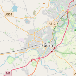
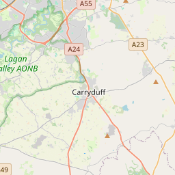
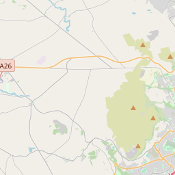
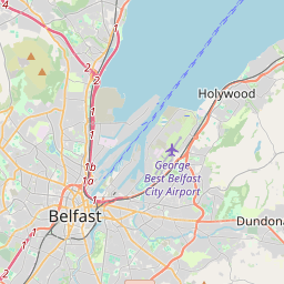
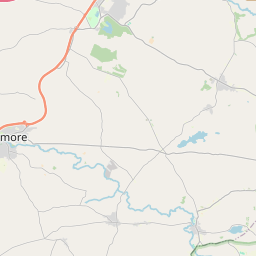
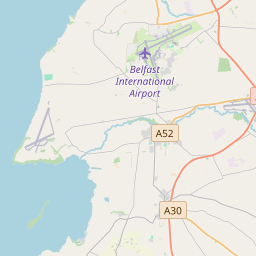

Leaflet | Map data © OpenStreetMap contributors
Fläche
Drumbeg (Antrim portion) hat eine Fläche von 6,2 km² / 1,524,2 Acres / 2,4 Quadratmeilen.
Townlands
There are 3 townlands that we know about in Drumbeg (Antrim portion). This represents 100,0% of all the area in Drumbeg (Antrim portion).
- Baile an Fhionnachaidh (see Ballyfinaghy (Baile an Fhionnachaidh) , Gemeinde Drumbeg (Antrim portion), Baronie Belfast Upper, Grafschaft Antrim)
- Ballyfinaghy (Baile an Fhionnachaidh) , Gemeinde Drumbeg (Antrim portion), Baronie Belfast Upper, Grafschaft Antrim 689 A, 2 R, 23 P
- Dún Muirígh (see Dunmurry (Dún Muirígh) , Gemeinde Drumbeg (Antrim portion), Baronie Belfast Upper, Grafschaft Antrim)
- Dunmurry (Dún Muirígh) , Gemeinde Drumbeg (Antrim portion), Baronie Belfast Upper, Grafschaft Antrim 479 A, 2 R, 0 P
- Old Forge, Gemeinde Drumbeg (Antrim portion), Baronie Belfast Upper, Grafschaft Antrim 355 A, 0 R, 7 P
 OpenStreetMap
Drumbeg (Antrim portion) wurde am 2 Aug 2016 von Stephen_Co_Antrim bei OpenStreetMap erfasst.
- View
- Edit