Based on data in OpenStreetMap, here is a list of townlands in Grange of Ballyscullion.
Grange of Ballyscullion ist in den Baronien Toome Upper.
Grange of Ballyscullion ist in den Grafschaften Antrim.
Grange of Ballyscullion bei Logainm.ie: Grange of Ballyscullion.
Karte
Befindet sich bei 54° 48' 5" N, 6° 24' 52" W.
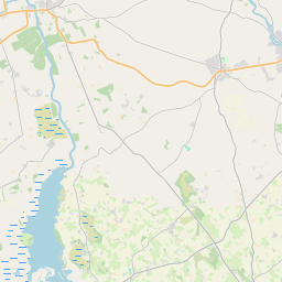
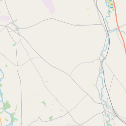
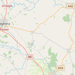
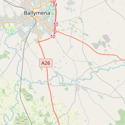

Leaflet | Map data © OpenStreetMap contributors
Fläche
Grange of Ballyscullion hat eine Fläche von 17,2 km² / 4,261,3 Acres / 6,7 Quadratmeilen.
Townlands
There are 9 townlands that we know about in Grange of Ballyscullion. This represents 100% of all the area in Grange of Ballyscullion.
- Achadh Bhearaigh (see Aghavary (Achadh Bhearaigh) , Gemeinde Grange of Ballyscullion, Baronie Toome Upper, Grafschaft Antrim)
- Aghavary (Achadh Bhearaigh) , Gemeinde Grange of Ballyscullion, Baronie Toome Upper, Grafschaft Antrim 400 A, 3 R, 9 P
- Ard na Glaise (see Ardnaglass (Ard na Glaise) , Gemeinde Grange of Ballyscullion, Baronie Toome Upper, Grafschaft Antrim)
- Ardnaglass (Ard na Glaise) , Gemeinde Grange of Ballyscullion, Baronie Toome Upper, Grafschaft Antrim 655 A, 2 R, 0 P
- Baile an Mhaí (see Gillistown (Baile an Mhaí) , Gemeinde Grange of Ballyscullion, Baronie Toome Upper, Grafschaft Antrim)
- Baile Tháilliúir (see Taylorstown (Baile Tháilliúir) , Gemeinde Grange of Ballyscullion, Baronie Toome Upper, Grafschaft Antrim)
- Cill Bhilis (see Kilvillis (Cill Bhilis) , Gemeinde Grange of Ballyscullion, Baronie Toome Upper, Grafschaft Antrim)
- Cill Eaglaise (see Killylaes (Cill Eaglaise) , Gemeinde Grange of Ballyscullion, Baronie Toome Upper, Grafschaft Antrim)
- Coillidh Bheithe (see Culnafay (Coillidh Bheithe) , Gemeinde Grange of Ballyscullion, Baronie Toome Upper, Grafschaft Antrim)
- Culnafay (Coillidh Bheithe) , Gemeinde Grange of Ballyscullion, Baronie Toome Upper, Grafschaft Antrim 359 A, 3 R, 11 P
- Gillistown (Baile an Mhaí) , Gemeinde Grange of Ballyscullion, Baronie Toome Upper, Grafschaft Antrim 555 A, 2 R, 1 P
- Grange Park (Páirc na Gráinsí) , Gemeinde Grange of Ballyscullion, Baronie Toome Upper, Grafschaft Antrim 269 A, 2 R, 12 P
- Killylaes (Cill Eaglaise) , Gemeinde Grange of Ballyscullion, Baronie Toome Upper, Grafschaft Antrim 84 A, 3 R, 11 P
- Kilvillis (Cill Bhilis) , Gemeinde Grange of Ballyscullion, Baronie Toome Upper, Grafschaft Antrim 119 A, 2 R, 29 P
- Millquarter, Gemeinde Grange of Ballyscullion, Baronie Toome Upper, Grafschaft Antrim 560 A, 2 R, 6 P
- Páirc na Gráinsí (see Grange Park (Páirc na Gráinsí) , Gemeinde Grange of Ballyscullion, Baronie Toome Upper, Grafschaft Antrim)
- Taylorstown (Baile Tháilliúir) , Gemeinde Grange of Ballyscullion, Baronie Toome Upper, Grafschaft Antrim 1255 A, 0 R, 11 P
 OpenStreetMap
Grange of Ballyscullion wurde am 13 Jul 2016 von Stephen_Co_Antrim bei OpenStreetMap erfasst.
- View
- Edit