Based on data in OpenStreetMap, here is a list of townlands in Kilraghts.
Kilraghts ist in den Baronien Dunluce Upper.
Kilraghts ist in den Grafschaften Antrim.
Kilraghts bei Logainm.ie: Kilraghts.
Karte
Befindet sich bei 55° 3' 40" N, 6° 24' 28" W.
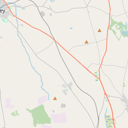
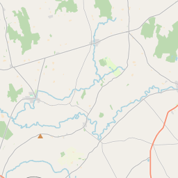
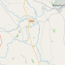
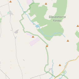
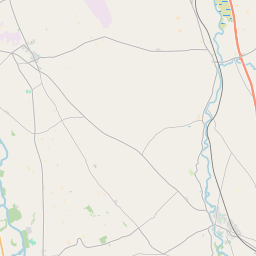
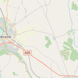
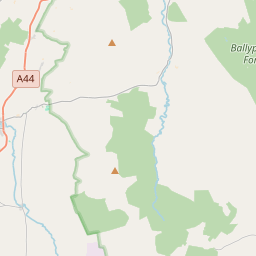
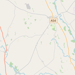
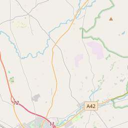
Leaflet | Map data © OpenStreetMap contributors
Fläche
Kilraghts hat eine Fläche von 20,8 km² / 5,151,6 Acres / 8,0 Quadratmeilen.
Townlands
There are 18 townlands that we know about in Kilraghts. This represents 100% of all the area in Kilraghts.
- Art-tighe Fearghail (see Artiferrall (Art-tighe Fearghail) , Gemeinde Kilraghts, Baronie Dunluce Upper, Grafschaft Antrim)
- Artiferrall (Art-tighe Fearghail) , Gemeinde Kilraghts, Baronie Dunluce Upper, Grafschaft Antrim 766 A, 1 R, 21 P
- Baile Locha (see Ballylough (Baile Locha) , Gemeinde Kilraghts, Baronie Dunluce Upper, Grafschaft Antrim)
- Ballylough (Baile Locha) , Gemeinde Kilraghts, Baronie Dunluce Upper, Grafschaft Antrim 284 A, 3 R, 11 P
- Carn na gCaorach (see Carnageeragh (Carn na gCaorach) , Gemeinde Kilraghts, Baronie Dunluce Upper, Grafschaft Antrim)
- Carnageeragh (Carn na gCaorach) , Gemeinde Kilraghts, Baronie Dunluce Upper, Grafschaft Antrim 205 A, 3 R, 25 P
- Cill Reachtais (see Kilraghts (Cill Reachtais) , Gemeinde Kilraghts, Baronie Dunluce Upper, Grafschaft Antrim)
- Coill Maige Angaidhe (see Kilmoyangey (Coill Maige Angaidhe) , Gemeinde Kilraghts, Baronie Dunluce Upper, Grafschaft Antrim)
- Coros Tachartaigh (see Crosstagherty (Coros Tachartaigh) , Gemeinde Kilraghts, Baronie Dunluce Upper, Grafschaft Antrim)
- Crosstagherty (Coros Tachartaigh) , Gemeinde Kilraghts, Baronie Dunluce Upper, Grafschaft Antrim 385 A, 3 R, 6 P
- Druim a'Chaorthainn (see Drumaqueran (Druim a'Chaorthainn) , Gemeinde Kilraghts, Baronie Dunluce Upper, Grafschaft Antrim)
- Druim na bPiast (see Drumbest (Druim na bPiast) , Gemeinde Kilraghts, Baronie Dunluce Upper, Grafschaft Antrim)
- Drumaqueran (Druim a'Chaorthainn) , Gemeinde Kilraghts, Baronie Dunluce Upper, Grafschaft Antrim 129 A, 3 R, 14 P
- Drumbest (Druim na bPiast) , Gemeinde Kilraghts, Baronie Dunluce Upper, Grafschaft Antrim 232 A, 1 R, 21 P
- Dungorbery, Gemeinde Kilraghts, Baronie Dunluce Upper, Grafschaft Antrim 164 A, 0 R, 6 P
- Ganaby, Gemeinde Kilraghts, Baronie Dunluce Upper, Grafschaft Antrim 198 A, 3 R, 9 P
- Islandmore, Gemeinde Kilraghts, Baronie Dunluce Upper, Grafschaft Antrim 169 A, 1 R, 8 P
- Kilmoyangey (Coill Maige Angaidhe) , Gemeinde Kilraghts, Baronie Dunluce Upper, Grafschaft Antrim 240 A, 1 R, 33 P
- Kilraghts (Cill Reachtais) , Gemeinde Kilraghts, Baronie Dunluce Upper, Grafschaft Antrim 428 A, 2 R, 9 P
- Knockanavery, Gemeinde Kilraghts, Baronie Dunluce Upper, Grafschaft Antrim 272 A, 2 R, 2 P
- Lag a Choire (see Legacurry (Lag a Choire) , Gemeinde Kilraghts, Baronie Dunluce Upper, Grafschaft Antrim)
- Legacurry (Lag a Choire) , Gemeinde Kilraghts, Baronie Dunluce Upper, Grafschaft Antrim 224 A, 3 R, 28 P
- Lios Buidhe (see Lisboy (Lios Buidhe) , Gemeinde Kilraghts, Baronie Dunluce Upper, Grafschaft Antrim)
- Lisboy (Lios Buidhe) , Gemeinde Kilraghts, Baronie Dunluce Upper, Grafschaft Antrim 203 A, 0 R, 1 P
- Lower Magheraboy (see Magheraboy Lower (Machaire Buidhe) , Gemeinde Kilraghts, Baronie Dunluce Upper, Grafschaft Antrim)
- Machaire Buidhe (see Magheraboy Lower (Machaire Buidhe) , Gemeinde Kilraghts, Baronie Dunluce Upper, Grafschaft Antrim)
- Machaire Buidhe (see Magheraboy Upper (Machaire Buidhe) , Gemeinde Kilraghts, Baronie Dunluce Upper, Grafschaft Antrim)
- Magheraboy Lower (Machaire Buidhe) , Gemeinde Kilraghts, Baronie Dunluce Upper, Grafschaft Antrim 230 A, 1 R, 26 P
- Magheraboy Upper (Machaire Buidhe) , Gemeinde Kilraghts, Baronie Dunluce Upper, Grafschaft Antrim 442 A, 0 R, 24 P
- Smallquarter, Gemeinde Kilraghts, Baronie Dunluce Upper, Grafschaft Antrim 369 A, 2 R, 4 P
- Tobar Bile (see Toberbilly (Tobar Bile) , Gemeinde Kilraghts, Baronie Dunluce Upper, Grafschaft Antrim)
- Toberbilly (Tobar Bile) , Gemeinde Kilraghts, Baronie Dunluce Upper, Grafschaft Antrim 202 A, 3 R, 6 P
- Upper Magheraboy (see Magheraboy Upper (Machaire Buidhe) , Gemeinde Kilraghts, Baronie Dunluce Upper, Grafschaft Antrim)
 OpenStreetMap
Kilraghts wurde am 7 Jul 2016 von Stephen_Co_Antrim bei OpenStreetMap erfasst.
- View
- Edit