Based on data in OpenStreetMap, here is a list of townlands in Haroldstown.
Haroldstown ist in den Baronien Rathvilly.
Haroldstown ist in den Grafschaften Carlow.
Haroldstown bei Logainm.ie: Haroldstown.
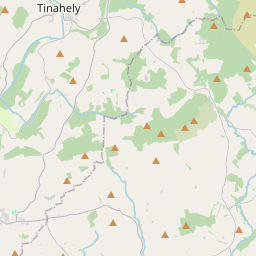
Karte
Befindet sich bei 52° 51' 0" N, 6° 37' 35" W.
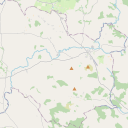
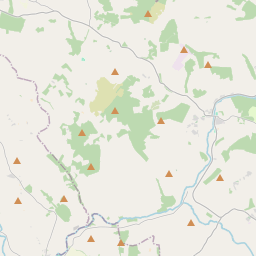
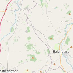
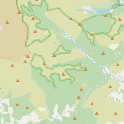
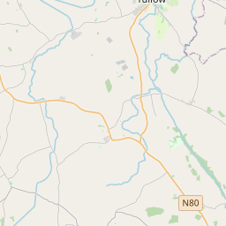
Leaflet | Map data © OpenStreetMap contributors
Fläche
Haroldstown hat eine Fläche von 11,5 km² / 2,847,9 Acres / 4,4 Quadratmeilen.
Townlands
There are 9 townlands that we know about in Haroldstown. This represents 100% of all the area in Haroldstown.
- Baile Arúil (see Haroldstown (Baile Arúil) , Gemeinde Haroldstown, Baronie Rathvilly, Grafschaft Carlow)
- Baile Ghallduibh Íochtarach (see Ballykilduff Lower (Baile Ghallduibh Íochtarach) , Gemeinde Haroldstown, Baronie Rathvilly, Grafschaft Carlow)
- Baile Ghallduibh Uachtarach (see Ballykilduff Upper (Baile Ghallduibh Uachtarach) , Gemeinde Haroldstown, Baronie Rathvilly, Grafschaft Carlow)
- Ballykilduff Lower (Baile Ghallduibh Íochtarach) , Gemeinde Haroldstown, Baronie Rathvilly, Grafschaft Carlow 252 A, 1 R, 33 P
- Ballykilduff Upper (Baile Ghallduibh Uachtarach) , Gemeinde Haroldstown, Baronie Rathvilly, Grafschaft Carlow 316 A, 2 R, 39 P
- Ceathrú an Naisigh (see Nashe's Quarter (Ceathrú an Naisigh) , Gemeinde Haroldstown, Baronie Rathvilly, Grafschaft Carlow)
- Coolmanagh Lower (Cúil Mhaine Íochtarach) , Gemeinde Haroldstown, Baronie Rathvilly, Grafschaft Carlow 298 A, 1 R, 36 P
- Coolmanagh Upper (Cúil Mhaine Uachtarach) , Gemeinde Haroldstown, Baronie Rathvilly, Grafschaft Carlow 540 A, 0 R, 31 P
- Cúil Mhaine Íochtarach (see Coolmanagh Lower (Cúil Mhaine Íochtarach) , Gemeinde Haroldstown, Baronie Rathvilly, Grafschaft Carlow)
- Cúil Mhaine Uachtarach (see Coolmanagh Upper (Cúil Mhaine Uachtarach) , Gemeinde Haroldstown, Baronie Rathvilly, Grafschaft Carlow)
- An Dufair (see Duffery (An Dufair) , Gemeinde Haroldstown, Baronie Rathvilly, Grafschaft Carlow)
- Duffery (An Dufair) , Gemeinde Haroldstown, Baronie Rathvilly, Grafschaft Carlow 343 A, 2 R, 32 P
- Haroldstown (Baile Arúil) , Gemeinde Haroldstown, Baronie Rathvilly, Grafschaft Carlow 349 A, 3 R, 13 P
- Lower Ballykilduff (see Ballykilduff Lower (Baile Ghallduibh Íochtarach) , Gemeinde Haroldstown, Baronie Rathvilly, Grafschaft Carlow)
- Lower Coolmanagh (see Coolmanagh Lower (Cúil Mhaine Íochtarach) , Gemeinde Haroldstown, Baronie Rathvilly, Grafschaft Carlow)
- Nashe's Quarter (Ceathrú an Naisigh) , Gemeinde Haroldstown, Baronie Rathvilly, Grafschaft Carlow 211 A, 3 R, 28 P
- Raheen (An Ráithín) , Gemeinde Haroldstown, Baronie Rathvilly, Grafschaft Carlow 421 A, 0 R, 7 P
- An Ráithín (see Raheen (An Ráithín) , Gemeinde Haroldstown, Baronie Rathvilly, Grafschaft Carlow)
- An Srath Loiscthe (see Stralusky (An Srath Loiscthe) , Gemeinde Haroldstown, Baronie Rathvilly, Grafschaft Carlow)
- Stralusky (An Srath Loiscthe) , Gemeinde Haroldstown, Baronie Rathvilly, Grafschaft Carlow 113 A, 2 R, 8 P
- Upper Ballykilduff (see Ballykilduff Upper (Baile Ghallduibh Uachtarach) , Gemeinde Haroldstown, Baronie Rathvilly, Grafschaft Carlow)
- Upper Coolmanagh (see Coolmanagh Upper (Cúil Mhaine Uachtarach) , Gemeinde Haroldstown, Baronie Rathvilly, Grafschaft Carlow)
 OpenStreetMap
Haroldstown wurde am 14 Jun 2012 von brianh bei OpenStreetMap erfasst.
- View
- Edit