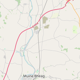
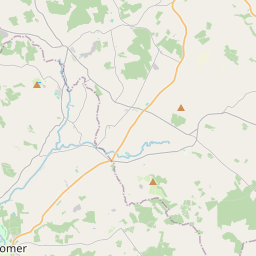
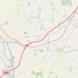
Based on data in OpenStreetMap, here is a list of townlands in Tullowcreen.
Tullowcreen ist in den Baronien Idrone West.
Tullowcreen ist in den Grafschaften Carlow.
Tullowcreen bei Logainm.ie: Tullowcreen.
Karte
Befindet sich bei 52° 46' 31" N, 7° 0' 55" W.


Leaflet | Map data © OpenStreetMap contributors
Fläche
Tullowcreen hat eine Fläche von 23,7 km² / 5,855,9 Acres / 9,1 Quadratmeilen.
Townlands
There are 12 townlands that we know about in Tullowcreen. This represents 100% of all the area in Tullowcreen.
- Agharue (An tÁth Rua) , Gemeinde Tullowcreen, Baronie Idrone West, Grafschaft Carlow 716 A, 0 R, 38 P
- An tÁth Rua (see Agharue (An tÁth Rua) , Gemeinde Tullowcreen, Baronie Idrone West, Grafschaft Carlow)
- Baile an Ghabhann (see Ballygowan (Baile an Ghabhann) , Gemeinde Tullowcreen, Baronie Idrone West, Grafschaft Carlow)
- Ballygowan (Baile an Ghabhann) , Gemeinde Tullowcreen, Baronie Idrone West, Grafschaft Carlow 276 A, 3 R, 20 P
- Boolyrathornan (aka Tomard) , Gemeinde Tullowcreen, Baronie Idrone West, Grafschaft Carlow 288 A, 0 R, 16 P
- Boolyvannanan (Buaile Uí Mhanannáin) , Gemeinde Tullowcreen, Baronie Idrone West, Grafschaft Carlow 375 A, 1 R, 26 P
- Buaile Uí Mhanannáin (see Boolyvannanan (Buaile Uí Mhanannáin) , Gemeinde Tullowcreen, Baronie Idrone West, Grafschaft Carlow)
- Coolnakisha (Cúil na Cise) , Gemeinde Tullowcreen, Baronie Idrone West, Grafschaft Carlow 1304 A, 0 R, 15 P
- An Corrán Loiscthe (see Craanlusky (An Corrán Loiscthe) , Gemeinde Tullowcreen, Baronie Idrone West, Grafschaft Carlow)
- Corrán Uí Mhanannáin (see Cranavonane (Corrán Uí Mhanannáin) , Gemeinde Tullowcreen, Baronie Idrone West, Grafschaft Carlow)
- Craanlusky (An Corrán Loiscthe) , Gemeinde Tullowcreen, Baronie Idrone West, Grafschaft Carlow 684 A, 1 R, 35 P
- Cranavonane (Corrán Uí Mhanannáin) , Gemeinde Tullowcreen, Baronie Idrone West, Grafschaft Carlow 757 A, 0 R, 37 P
- Cúil na Cise (see Coolnakisha (Cúil na Cise) , Gemeinde Tullowcreen, Baronie Idrone West, Grafschaft Carlow)
- An Ghléib (see Glebe (An Ghléib) , Gemeinde Tullowcreen, Baronie Idrone West, Grafschaft Carlow)
- Glebe (An Ghléib) , Gemeinde Tullowcreen, Baronie Idrone West, Grafschaft Carlow 27 A, 0 R, 28 P
- Lower Tomard (see Tomard Lower (An Tom Ard Íochtarach) , Gemeinde Tullowcreen, Baronie Idrone West, Grafschaft Carlow)
- Ráth Bhiondain (see Rathvinden (Ráth Bhiondain) , Gemeinde Tullowcreen, Baronie Idrone West, Grafschaft Carlow)
- Ráth Thornáin (see Rathornan (Ráth Thornáin) , Gemeinde Tullowcreen, Baronie Idrone West, Grafschaft Carlow)
- Rathornan (Ráth Thornáin) , Gemeinde Tullowcreen, Baronie Idrone West, Grafschaft Carlow 318 A, 3 R, 4 P
- Rathvinden (Ráth Bhiondain) , Gemeinde Tullowcreen, Baronie Idrone West, Grafschaft Carlow 11 A, 0 R, 13 P
- An Tom Ard Íochtarach (see Tomard Lower (An Tom Ard Íochtarach) , Gemeinde Tullowcreen, Baronie Idrone West, Grafschaft Carlow)
- An Tom Ard Uachtarach (see Tomard Upper (An Tom Ard Uachtarach) , Gemeinde Tullowcreen, Baronie Idrone West, Grafschaft Carlow)
- Tomard (see Boolyrathornan (aka Tomard) , Gemeinde Tullowcreen, Baronie Idrone West, Grafschaft Carlow)
- Tomard Lower (An Tom Ard Íochtarach) , Gemeinde Tullowcreen, Baronie Idrone West, Grafschaft Carlow 501 A, 1 R, 34 P
- Tomard Upper (An Tom Ard Uachtarach) , Gemeinde Tullowcreen, Baronie Idrone West, Grafschaft Carlow 594 A, 3 R, 27 P
- Upper Tomard (see Tomard Upper (An Tom Ard Uachtarach) , Gemeinde Tullowcreen, Baronie Idrone West, Grafschaft Carlow)
 OpenStreetMap
Tullowcreen wurde am 9 Jul 2012 von brianh bei OpenStreetMap erfasst.
- View
- Edit

 JOSM
JOSM iD
iD