Based on data in OpenStreetMap, here is a list of townlands in Inishargy.
Inishargy ist in den Baronien Upper Ards.
Inishargy ist in den Grafschaften Down.
Inishargy bei Logainm.ie: Inishargy.
Karte
Befindet sich bei 54° 29' 44" N, 5° 30' 47" W.
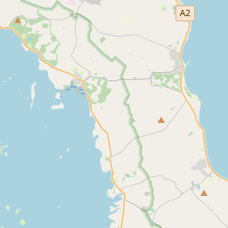
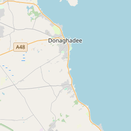
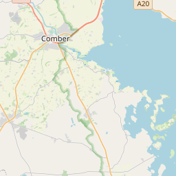
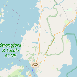
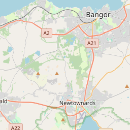
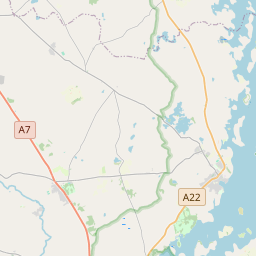
Leaflet | Map data © OpenStreetMap contributors
Fläche
Inishargy hat eine Fläche von 24,1 km² / 5,949,7 Acres / 9,3 Quadratmeilen.
Townlands
There are 11 townlands that we know about in Inishargy. This represents 91,0% of all the area in Inishargy.
- Baile Oibicín (see Ballyobegan (Baile Oibicín) , Gemeinde Inishargy, Baronie Upper Ards, Grafschaft Down)
- Baile Rodanaí (see Roddans (Baile Rodanaí) , Gemeinde Inishargy, Baronie Upper Ards, Grafschaft Down)
- Baile Uí Gharbhagain (see Ballygarvan (Baile Uí Gharbhagain) , Gemeinde Inishargy, Baronie Upper Ards, Grafschaft Down)
- Baile Uí Uiginn (see Balliggan (Baile Uí Uiginn) , Gemeinde Inishargy, Baronie Upper Ards, Grafschaft Down)
- Balliggan (Baile Uí Uiginn) , Gemeinde Inishargy, Baronie Upper Ards, Grafschaft Down 318 A, 1 R, 35 P
- Ballygarvan (Baile Uí Gharbhagain) , Gemeinde Inishargy, Baronie Upper Ards, Grafschaft Down 561 A, 2 R, 39 P
- Ballylimp, Gemeinde Inishargy, Baronie Upper Ards, Grafschaft Down 364 A, 2 R, 9 P
- Ballyobegan (Baile Oibicín) , Gemeinde Inishargy, Baronie Upper Ards, Grafschaft Down 577 A, 0 R, 10 P
- Ceathrú an Iascaire (see Fish Quarter (Ceathrú an Iascaire) , Gemeinde Inishargy, Baronie Upper Ards, Grafschaft Down)
- Ceathrú na gCailleach (see Nunsquarter (Ceathrú na gCailleach) , Gemeinde Inishargy, Baronie Upper Ards, Grafschaft Down)
- Cill Ghobáin (see Kircubbin (Cill Ghobáin) , Gemeinde Inishargy, Baronie Upper Ards, Grafschaft Down)
- Echlinville, Gemeinde Inishargy, Baronie Upper Ards, Grafschaft Down 482 A, 3 R, 2 P
- Fish Quarter (Ceathrú an Iascaire) , Gemeinde Inishargy, Baronie Upper Ards, Grafschaft Down 271 A, 3 R, 12 P
- Inis Mhic Cairrge (see Inishargy (Inis Mhic Cairrge) , Gemeinde Inishargy, Baronie Upper Ards, Grafschaft Down)
- Inishargy (Inis Mhic Cairrge) , Gemeinde Inishargy, Baronie Upper Ards, Grafschaft Down 1029 A, 2 R, 31 P
- Kircubbin (Cill Ghobáin) , Gemeinde Inishargy, Baronie Upper Ards, Grafschaft Down 573 A, 0 R, 17 P
- Nunsquarter (Ceathrú na gCailleach) , Gemeinde Inishargy, Baronie Upper Ards, Grafschaft Down 182 A, 2 R, 37 P
- Roddans (Baile Rodanaí) , Gemeinde Inishargy, Baronie Upper Ards, Grafschaft Down 402 A, 2 R, 29 P
- Rowreagh (An Rubha Riabhach) , Gemeinde Inishargy, Baronie Upper Ards, Grafschaft Down 648 A, 1 R, 18 P
- An Rubha Riabhach (see Rowreagh (An Rubha Riabhach) , Gemeinde Inishargy, Baronie Upper Ards, Grafschaft Down)
 OpenStreetMap
Inishargy wurde am 13 Mai 2015 von Stephen_Co_Antrim bei OpenStreetMap erfasst.
- View
- Edit