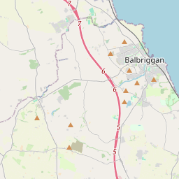
Based on data in OpenStreetMap, here is a list of townlands in Naul.
Naul ist in den Baronien Balrothery West.
Naul ist in den Grafschaften Dublin.
Naul bei Logainm.ie: Naul.
Karte
Befindet sich bei 53° 34' 57" N, 6° 16' 46" W.


Leaflet | Map data © OpenStreetMap contributors
Fläche
Naul hat eine Fläche von 10,7 km² / 2,640,4 Acres / 4,1 Quadratmeilen.
Townlands
There are 15 townlands that we know about in Naul. This represents 100% of all the area in Naul.
- An Aill (see Naul (An Aill) , Gemeinde Naul, Baronie Balrothery West, Grafschaft Dublin)
- Baile an Hasardaigh (see Hazardstown (Baile an Hasardaigh) , Gemeinde Naul, Baronie Balrothery West, Grafschaft Dublin)
- Baile Fhlaicéid (see Flacketstown (Baile Fhlaicéid) , Gemeinde Naul, Baronie Balrothery West, Grafschaft Dublin)
- Baile Héin (see Hynestown (Baile Héin) , Gemeinde Naul, Baronie Balrothery West, Grafschaft Dublin)
- Baile Leithghlinne (see Lecklintown (Baile Leithghlinne) , Gemeinde Naul, Baronie Balrothery West, Grafschaft Dublin)
- Baile Raghnaill (see Reynoldstown (Baile Raghnaill) , Gemeinde Naul, Baronie Balrothery West, Grafschaft Dublin)
- An Baile Thiar (see Westown (An Baile Thiar) , Gemeinde Naul, Baronie Balrothery West, Grafschaft Dublin)
- Cabinhill (Cnoc an Chábáin) , Gemeinde Naul, Baronie Balrothery West, Grafschaft Dublin 82 A, 2 R, 31 P
- An Chúil Fhuar (see Coolfores (An Chúil Fhuar) , Gemeinde Naul, Baronie Balrothery West, Grafschaft Dublin)
- Cnoc an Chábáin (see Cabinhill (Cnoc an Chábáin) , Gemeinde Naul, Baronie Balrothery West, Grafschaft Dublin)
- Coolfores (An Chúil Fhuar) , Gemeinde Naul, Baronie Balrothery West, Grafschaft Dublin 118 A, 2 R, 0 P
- Daichead Acra (see Fortyacres (Daichead Acra) , Gemeinde Naul, Baronie Balrothery West, Grafschaft Dublin)
- Doolagh (Dúlach) , Gemeinde Naul, Baronie Balrothery West, Grafschaft Dublin 65 A, 0 R, 16 P
- Dúlach (see Doolagh (Dúlach) , Gemeinde Naul, Baronie Balrothery West, Grafschaft Dublin)
- Flacketstown (Baile Fhlaicéid) , Gemeinde Naul, Baronie Balrothery West, Grafschaft Dublin 112 A, 0 R, 36 P
- Fortyacres (Daichead Acra) , Gemeinde Naul, Baronie Balrothery West, Grafschaft Dublin 61 A, 1 R, 18 P
- Hazardstown (Baile an Hasardaigh) , Gemeinde Naul, Baronie Balrothery West, Grafschaft Dublin 160 A, 2 R, 30 P
- Hynestown (Baile Héin) , Gemeinde Naul, Baronie Balrothery West, Grafschaft Dublin 277 A, 2 R, 34 P
- Lecklintown (Baile Leithghlinne) , Gemeinde Naul, Baronie Balrothery West, Grafschaft Dublin 217 A, 0 R, 21 P
- Loch Meáin (see Loughmain (Loch Meáin) , Gemeinde Naul, Baronie Balrothery West, Grafschaft Dublin)
- Loughmain (Loch Meáin) , Gemeinde Naul, Baronie Balrothery West, Grafschaft Dublin 119 A, 1 R, 39 P
- Naul (An Aill) , Gemeinde Naul, Baronie Balrothery West, Grafschaft Dublin 295 A, 2 R, 28 P
- An Ráth Bheag (see Rath Little (An Ráth Bheag) , Gemeinde Naul, Baronie Balrothery West, Grafschaft Dublin)
- Rath Great (An Ráth Mhór) , Gemeinde Naul, Baronie Balrothery West, Grafschaft Dublin 193 A, 0 R, 23 P
- Rath Little (An Ráth Bheag) , Gemeinde Naul, Baronie Balrothery West, Grafschaft Dublin 139 A, 2 R, 35 P
- An Ráth Mhór (see Rath Great (An Ráth Mhór) , Gemeinde Naul, Baronie Balrothery West, Grafschaft Dublin)
- Reynoldstown (Baile Raghnaill) , Gemeinde Naul, Baronie Balrothery West, Grafschaft Dublin 125 A, 3 R, 0 P
- Uininn (see Winnings (Uininn) , Gemeinde Naul, Baronie Balrothery West, Grafschaft Dublin)
- Westown (An Baile Thiar) , Gemeinde Naul, Baronie Balrothery West, Grafschaft Dublin 611 A, 2 R, 13 P
- Winnings (Uininn) , Gemeinde Naul, Baronie Balrothery West, Grafschaft Dublin 59 A, 2 R, 9 P
 OpenStreetMap
Naul wurde am 10 Aug 2015 von brianh bei OpenStreetMap erfasst.
- View
- Edit

 JOSM
JOSM iD
iD