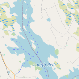
Based on data in OpenStreetMap, here is a list of townlands in the Electoral Division / ED / District Electoral Division of Cloonkeen.
Cloonkeen ist in der Grafschaft
Cloonkeen is not matched up to Logainm.ie yet.
Karte
Befindet sich bei 53° 32' 38" N, 8° 37' 40" W.


Leaflet | Map data © OpenStreetMap contributors
Fläche
Cloonkeen hat eine Fläche von 20,4 km² / 5,050,0 Acres / 7,9 Quadratmeilen.
Townlands
Uns sind 17 Townlands in bekannt. Das entspricht 100% der Fläche in .
- Ballyedmond 638 A, 2 R, 24 P
- Cappantruhaun 290 A, 0 R, 23 P
- Cloonagh 567 A, 1 R, 31 P
- Cloonboo Beg 134 A, 3 R, 3 P
- Cloonboo More 182 A, 3 R, 4 P
- Cloonkeennagran 423 A, 2 R, 31 P
- Cloonkeen (Waldron) 188 A, 3 R, 35 P
- Cogaula 616 A, 0 R, 14 P
- Cornaminaun 54 A, 3 R, 0 P
- Derreen Lower 181 A, 1 R, 18 P
- Derreen Upper 353 A, 0 R, 33 P
- Fortbrown 270 A, 2 R, 9 P
- Kead 449 A, 3 R, 5 P
- Laughil 207 A, 1 R, 12 P
- Lenaboy 101 A, 3 R, 10 P
- Lissacarha 262 A, 0 R, 34 P
- Monairmore 126 A, 1 R, 18 P
 OpenStreetMap
Cloonkeen wurde am 18 Dez 2016 von Boggedy bei OpenStreetMap erfasst.
- View
- Edit

 JOSM
JOSM iD
iD