Based on data in OpenStreetMap, here is a list of townlands in the Electoral Division / ED / District Electoral Division of Oranmore.
Oranmore ist in der Grafschaft
Oranmore is not matched up to Logainm.ie yet.
Karte
Befindet sich bei 53° 16' 37" N, 8° 54' 6" W.
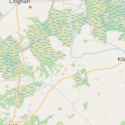
Leaflet | Map data © OpenStreetMap contributors
Fläche
Oranmore hat eine Fläche von 22,4 km² / 5,523,8 Acres / 8,6 Quadratmeilen.
Townlands
Uns sind 15 Townlands in bekannt. Das entspricht 100% der Fläche in .
- Ballynageeha 215 A, 0 R, 33 P
- Bushfield 287 A, 3 R, 18 P
- Carrowmoneash 346 A, 0 R, 25 P
- Deerpark 66 A, 1 R, 7 P
- Frenchfort 1379 A, 1 R, 26 P
- Glennascaul 949 A, 2 R, 15 P
- Innplot 18 A, 2 R, 37 P
- Millplot 5 A, 2 R, 2 P
- Moneymore East 620 A, 3 R, 37 P
- Moneymore West 323 A, 1 R, 14 P
- Oranbeg 519 A, 1 R, 3 P
- Oranmore 318 A, 1 R, 9 P
- Rinn 347 A, 2 R, 37 P
- Rockhill 50 A, 0 R, 39 P
- Rocklands 75 A, 0 R, 27 P
 OpenStreetMap
Oranmore wurde am 16 Aug 2014 von Boggedy bei OpenStreetMap erfasst.
- View
- Edit