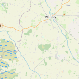
Based on data in OpenStreetMap, here is a list of townlands in the Electoral Division / ED / District Electoral Division of Cashel West.
Cashel West ist in der Grafschaft
Cashel West is not matched up to Logainm.ie yet.
Karte
Befindet sich bei 53° 34' 28" N, 7° 57' 19" W.


Leaflet | Map data © OpenStreetMap contributors
Fläche
Cashel West hat eine Fläche von 62,7 km² / 15,499,4 Acres / 24,2 Quadratmeilen.
Townlands
Uns sind 57 Townlands in bekannt. Das entspricht 60,4% der Fläche in .
- Aghakeel 50 A, 1 R, 2 P
- Aghavadden 124 A, 1 R, 27 P
- Aghnacross 85 A, 2 R, 22 P
- Ballagh 219 A, 1 R, 24 P
- Ballynahinch 428 A, 0 R, 9 P
- Ballyrevagh 236 A, 2 R, 22 P
- Brearoge Island 0 A, 1 R, 9 P
- Bush Island 0 A, 0 R, 12 P
- Carrickmoran 89 A, 2 R, 17 P
- Carrow Beg 225 A, 3 R, 36 P
- Carrowdunican 68 A, 2 R, 31 P
- Carrow More 87 A, 2 R, 4 P
- Carrowrory 138 A, 0 R, 7 P
- Cartoon 66 A, 3 R, 34 P
- Cashel 323 A, 1 R, 20 P
- Claras 533 A, 3 R, 18 P
- Clawinch 44 A, 0 R, 11 P
- Cleraun 340 A, 3 R, 4 P
- Cloonmee 398 A, 0 R, 6 P
- Collum 399 A, 1 R, 0 P
- Commons 37 A, 0 R, 12 P
- Cornadowagh 518 A, 1 R, 8 P
- Corrool (Brennan) 170 A, 1 R, 3 P
- Corrool (Fox) 205 A, 2 R, 24 P
- Corrool (Kenny) 312 A, 1 R, 37 P
- Cross 121 A, 3 R, 24 P
- Cullentragh (Cashel Civil Parish) 142 A, 2 R, 33 P
- Cullentragh (Rathcline Civil Parish) 513 A, 1 R, 7 P
- Culnagore 188 A, 1 R, 22 P
- Derrydarragh 245 A, 3 R, 37 P
- Drumnee 566 A, 2 R, 18 P
- Elfeet (Adamson) 188 A, 2 R, 32 P
- Elfeet (Burke) 81 A, 1 R, 13 P
- Fortwilliam 195 A, 3 R, 3 P
- Girls' Island 0 A, 2 R, 32 P
- Glebe 54 A, 3 R, 13 P
- Greenhall Lower 102 A, 0 R, 19 P
- Greenhall Upper 232 A, 0 R, 11 P
- Horse Island 2 A, 2 R, 37 P
- Inchcleraun 153 A, 1 R, 16 P
- Kings Island 19 A, 3 R, 0 P
- Leab 116 A, 3 R, 14 P
- Leveran Island 0 A, 3 R, 14 P
- Lismagawley 42 A, 3 R, 13 P
- Lismagawley Bog 25 A, 3 R, 0 P
- Lismagawley Meadow 53 A, 2 R, 37 P
- Loughfarm 127 A, 3 R, 5 P
- Nut Island 13 A, 3 R, 10 P
- Pollagh 296 A, 1 R, 7 P
- Portanure 375 A, 1 R, 38 P
- Portanure Bog 54 A, 0 R, 19 P
- Priest's Island 4 A, 3 R, 13 P
- Red Island 3 A, 1 R, 0 P
- Red Island 3 A, 3 R, 14 P
- Saints Island 202 A, 0 R, 30 P
- Sand Island 7 A, 3 R, 0 P
- Tipper 120 A, 2 R, 5 P
 OpenStreetMap
Cashel West wurde am 19 Jul 2013 von PaddyMatthews bei OpenStreetMap erfasst.
- View
- Edit

 JOSM
JOSM iD
iD