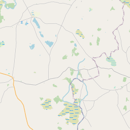
Based on data in OpenStreetMap, here is a list of townlands in the Electoral Division / ED / District Electoral Division of Ballinrobe.
Ballinrobe ist in der Grafschaft
Ballinrobe is not matched up to Logainm.ie yet.
Karte
Befindet sich bei 53° 37' 53" N, 9° 15' 4" W.


Leaflet | Map data © OpenStreetMap contributors
Fläche
Ballinrobe hat eine Fläche von 55,5 km² / 13,704,7 Acres / 21,4 Quadratmeilen.
Townlands
Uns sind 52 Townlands in bekannt. Das entspricht 79,6% der Fläche in .
- Annagh 105 A, 3 R, 3 P
- Ballinaya 231 A, 0 R, 37 P
- Ballinrobe Demesne 296 A, 1 R, 3 P
- Caher 131 A, 1 R, 27 P
- Cahercroobeen 63 A, 1 R, 18 P
- Cahernabudogy 66 A, 3 R, 19 P
- Carn 95 A, 0 R, 30 P
- Carrowmore 135 A, 1 R, 3 P
- Carrownalecka 277 A, 3 R, 38 P
- Cartron 184 A, 1 R, 10 P
- Cavanquarter 137 A, 3 R, 11 P
- Clooncorraun 248 A, 1 R, 26 P
- Cloonee 471 A, 3 R, 27 P
- Cloonenagh 280 A, 1 R, 6 P
- Cloongowla 618 A, 2 R, 2 P
- Cloonkerry 403 A, 0 R, 33 P
- Cloonliffen 185 A, 3 R, 39 P
- Cornaroya 356 A, 2 R, 11 P
- Cow Island 0 A, 3 R, 1 P
- Crane Island 0 A, 3 R, 39 P
- Creagh Demesne 644 A, 1 R, 14 P
- Curraboy (Kilmaine) 117 A, 3 R, 19 P
- Curraboy (Knox) 236 A, 0 R, 32 P
- Curramore 238 A, 3 R, 30 P
- Cuslough Demesne 342 A, 0 R, 3 P
- Devenish Island 12 A, 1 R, 21 P
- Doonbeg Island 0 A, 2 R, 0 P
- Friarsquarter East 222 A, 1 R, 13 P
- Friarsquarter West 241 A, 1 R, 1 P
- Gorteenlynagh 125 A, 1 R, 39 P
- Inishdurra 16 A, 3 R, 11 P
- Kilkeeran 245 A, 1 R, 22 P
- Killosheheen 248 A, 1 R, 18 P
- Knockadoon 126 A, 1 R, 15 P
- Knockanotish 292 A, 3 R, 7 P
- Knockfereen 79 A, 2 R, 34 P
- Knockglass 311 A, 3 R, 13 P
- Knocklahard 219 A, 3 R, 6 P
- Knocknagulshy 275 A, 3 R, 28 P
- Knocknakillew 373 A, 2 R, 13 P
- Knockroe 196 A, 1 R, 16 P
- Liskilleen 543 A, 1 R, 16 P
- Lissanisky 311 A, 1 R, 32 P
- Rahard 255 A, 1 R, 36 P
- Rathcarreen 147 A, 0 R, 0 P
- Rathkelly 139 A, 2 R, 11 P
- Rathredmond 332 A, 1 R, 4 P
- Rocksborough North 109 A, 0 R, 10 P
- Rocksborough South 178 A, 0 R, 39 P
- Shangorman Island 6 A, 1 R, 17 P
- Springvale 27 A, 0 R, 14 P
- Stare Island 2 A, 2 R, 17 P
 OpenStreetMap
Ballinrobe wurde am 6 Dez 2016 von Boggedy bei OpenStreetMap erfasst.
- View
- Edit

 JOSM
JOSM iD
iD