Based on data in OpenStreetMap, here is a list of townlands in the Electoral Division / ED / District Electoral Division of Tobercurry.
Tobercurry ist in der Grafschaft
Tobercurry is not matched up to Logainm.ie yet.
Karte
Befindet sich bei 54° 3' 36" N, 8° 44' 6" W.
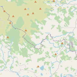
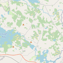
Leaflet | Map data © OpenStreetMap contributors
Fläche
Tobercurry hat eine Fläche von 37,8 km² / 9,345,6 Acres / 14,6 Quadratmeilen.
Townlands
Uns sind 17 Townlands in bekannt. Das entspricht 100% der Fläche in .
- Ballyara 238 A, 0 R, 4 P
- Ballyara (Knox) 386 A, 0 R, 0 P
- Carraun 352 A, 1 R, 14 P
- Carrowntober 650 A, 0 R, 33 P
- Carrowreagh (Cooper) 953 A, 3 R, 5 P
- Carrowreagh (Knox) 622 A, 3 R, 15 P
- Cloonarara 262 A, 0 R, 13 P
- Corsallagh 738 A, 2 R, 25 P
- Doomore 663 A, 3 R, 36 P
- Mullaghanarry 313 A, 1 R, 23 P
- Oghambaun 411 A, 1 R, 12 P
- Powellsborough 1043 A, 0 R, 15 P
- Pullagh 218 A, 0 R, 26 P
- Rathscanlon 604 A, 0 R, 33 P
- Rue 720 A, 2 R, 35 P
- Tobercurry 736 A, 1 R, 14 P
- Tullycusheen More 430 A, 1 R, 16 P
 OpenStreetMap
Tobercurry wurde am 17 Aug 2015 von NoelB bei OpenStreetMap erfasst.
- View
- Edit