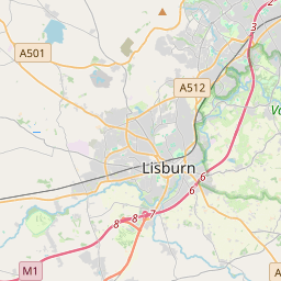
Based on data in OpenStreetMap, here is a list of townlands in the Electoral Division / ED / District Electoral Division of Bernagh.
Bernagh ist in der Grafschaft
Bernagh is not matched up to Logainm.ie yet.
Karte
Befindet sich bei 54° 29' 28" N, 6° 43' 58" W.


Leaflet | Map data © OpenStreetMap contributors
Fläche
Bernagh hat eine Fläche von 18,2 km² / 4,498,7 Acres / 7,0 Quadratmeilen.
Townlands
Uns sind 30 Townlands in bekannt. Das entspricht 100% der Fläche in .
- Altnavannog 137 A, 0 R, 21 P
- Bernagh 176 A, 0 R, 34 P
- Cavan 222 A, 1 R, 7 P
- Coash 146 A, 1 R, 31 P
- Coolcush 133 A, 2 R, 39 P
- Coolhill 212 A, 3 R, 32 P
- Cornamucklagh 169 A, 0 R, 25 P
- Culnagor 88 A, 0 R, 6 P
- Culnagrew 123 A, 1 R, 30 P
- Derrycreevy (Knox) 118 A, 0 R, 32 P
- Donnydeade 163 A, 2 R, 17 P
- Dreemore 247 A, 1 R, 7 P
- Drumharriff 35 A, 1 R, 24 P
- Drummuck 84 A, 2 R, 21 P
- Dungorman 163 A, 1 R, 4 P
- Killylack Glebe 72 A, 3 R, 11 P
- Killyneill 202 A, 1 R, 10 P
- Kingarve 169 A, 1 R, 34 P
- Lederg 45 A, 1 R, 6 P
- Lisdermot 93 A, 2 R, 32 P
- Lismulrevy 172 A, 1 R, 31 P
- Lisnaclin 88 A, 2 R, 12 P
- Lisnahoy 49 A, 0 R, 39 P
- Lowertown 184 A, 2 R, 11 P
- Lurgaboy 123 A, 0 R, 7 P
- Moygashel 316 A, 1 R, 17 P
- Mullaghadun 142 A, 0 R, 37 P
- Mullybrannon 284 A, 1 R, 11 P
- Stangmore (Knox) 211 A, 2 R, 17 P
- Tempanroe 120 A, 3 R, 20 P
 OpenStreetMap
Bernagh wurde am 2 Mär 2021 von b-unicycling bei OpenStreetMap erfasst.
- View
- Edit

 JOSM
JOSM iD
iD