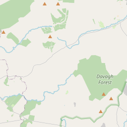
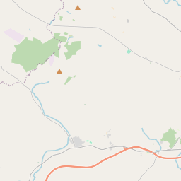
Based on data in OpenStreetMap, here is a list of townlands in the Electoral Division / ED / District Electoral Division of Clunahill.
Clunahill ist in der Grafschaft
Clunahill is not matched up to Logainm.ie yet.
Karte
Befindet sich bei 54° 35' 11" N, 7° 34' 7" W.


Leaflet | Map data © OpenStreetMap contributors
Fläche
Clunahill hat eine Fläche von 29,2 km² / 7,209,8 Acres / 11,3 Quadratmeilen.
Townlands
Uns sind 19 Townlands in bekannt. Das entspricht 100% der Fläche in .
- Annaghalough 164 A, 1 R, 32 P
- Carradoo Glebe 315 A, 3 R, 21 P
- Carradowa Glebe 199 A, 2 R, 10 P
- Carrick 365 A, 0 R, 33 P
- Carrickbwee Glebe 278 A, 1 R, 5 P
- Clunahill Glebe 406 A, 0 R, 19 P
- Coolavannagh 1414 A, 2 R, 33 P
- Cornashesk 233 A, 1 R, 24 P
- Curragh Glebe 105 A, 0 R, 7 P
- Drumnamalra 268 A, 0 R, 7 P
- Drumowen 299 A, 0 R, 13 P
- Garrison Glebe 261 A, 0 R, 39 P
- Gortnasoal Glebe 302 A, 0 R, 9 P
- Marrock Glebe 208 A, 3 R, 23 P
- Meenadoan 735 A, 2 R, 36 P
- Meenaheery Glebe 135 A, 2 R, 28 P
- Meenmossogue Glebe 289 A, 3 R, 11 P
- Prughlish 479 A, 0 R, 33 P
- Tully 747 A, 1 R, 21 P
 OpenStreetMap
Clunahill wurde am 2 Mär 2021 von b-unicycling bei OpenStreetMap erfasst.
- View
- Edit

 JOSM
JOSM iD
iD