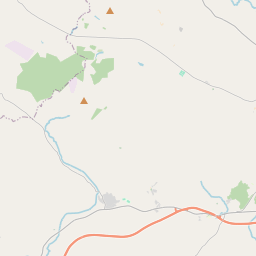
Based on data in OpenStreetMap, here is a list of townlands in the Electoral Division / ED / District Electoral Division of Moorfield.
Moorfield ist in der Grafschaft
Moorfield is not matched up to Logainm.ie yet.
Karte
Befindet sich bei 54° 29' 5" N, 7° 32' 55" W.


Leaflet | Map data © OpenStreetMap contributors
Fläche
Moorfield hat eine Fläche von 27,2 km² / 6,723,0 Acres / 10,5 Quadratmeilen.
Townlands
Uns sind 23 Townlands in bekannt. Das entspricht 100% der Fläche in .
- Corkhill 250 A, 1 R, 39 P
- Corkragh 93 A, 0 R, 9 P
- Crossan 363 A, 1 R, 34 P
- Dergany (Neville) 161 A, 0 R, 38 P
- Derrymacanna 148 A, 2 R, 23 P
- Doocrock 428 A, 0 R, 35 P
- Drumbinnion 260 A, 2 R, 14 P
- Feglish 368 A, 0 R, 28 P
- Ferney 409 A, 1 R, 25 P
- Hackincon 175 A, 2 R, 19 P
- Kinine 316 A, 3 R, 20 P
- Knocknagor 159 A, 2 R, 36 P
- Lettergash 613 A, 1 R, 8 P
- Lisdoo 155 A, 1 R, 37 P
- Lisnahanna 298 A, 2 R, 36 P
- Loughterush 301 A, 3 R, 34 P
- Meeltogues 146 A, 1 R, 31 P
- Moorfield 488 A, 2 R, 23 P
- Stralongford 286 A, 3 R, 31 P
- Tullymagough 113 A, 3 R, 38 P
- Tullynincrin 226 A, 3 R, 15 P
- Tullywee 134 A, 2 R, 15 P
- Tummery 820 A, 2 R, 9 P
 OpenStreetMap
Moorfield wurde am 4 Mär 2021 von b-unicycling bei OpenStreetMap erfasst.
- View
- Edit

 JOSM
JOSM iD
iD