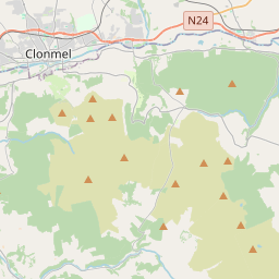
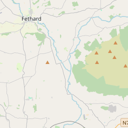
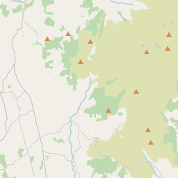
Based on data in OpenStreetMap, here is a list of townlands in Rathgormuck.
Rathgormuck ist in den Baronien Upperthird.
Rathgormuck ist in den Grafschaften Waterford.
Rathgormuck bei Logainm.ie: Rathgormuck.
Karte
Befindet sich bei 52° 17' 50" N, 7° 32' 55" W.


Leaflet | Map data © OpenStreetMap contributors
Fläche
Rathgormuck hat eine Fläche von 62,7 km² / 15,488,4 Acres / 24,2 Quadratmeilen.
Townlands
There are 25 townlands that we know about in Rathgormuck. This represents 100% of all the area in Rathgormuck.
- An tÁth Mór (see Aughmore (An tÁth Mór) , Gemeinde Rathgormuck, Baronie Upperthird, Grafschaft Waterford)
- Aughmore (An tÁth Mór) , Gemeinde Rathgormuck, Baronie Upperthird, Grafschaft Waterford 199 A, 3 R, 38 P
- Baile an Ghearrtha (see Ballingarra (Baile an Ghearrtha) , Gemeinde Rathgormuck, Baronie Upperthird, Grafschaft Waterford)
- Baile an Phaghanaigh (see Ballynafina (Baile an Phaghanaigh) , Gemeinde Rathgormuck, Baronie Upperthird, Grafschaft Waterford)
- Baile Uí Choileáin (see Ballycullane (Baile Uí Choileáin) , Gemeinde Rathgormuck, Baronie Upperthird, Grafschaft Waterford)
- Ballingarra (Baile an Ghearrtha) , Gemeinde Rathgormuck, Baronie Upperthird, Grafschaft Waterford 302 A, 2 R, 14 P
- Ballycullane (Baile Uí Choileáin) , Gemeinde Rathgormuck, Baronie Upperthird, Grafschaft Waterford 178 A, 2 R, 21 P
- Ballynafina (Baile an Phaghanaigh) , Gemeinde Rathgormuck, Baronie Upperthird, Grafschaft Waterford 254 A, 2 R, 29 P
- An Bhuaile Bheag (see Boolabeg (An Bhuaile Bheag) , Gemeinde Rathgormuck, Baronie Upperthird, Grafschaft Waterford)
- Boolabeg (An Bhuaile Bheag) , Gemeinde Rathgormuck, Baronie Upperthird, Grafschaft Waterford 239 A, 2 R, 27 P
- Boolacloghagh (Buaile na Cloiche) , Gemeinde Rathgormuck, Baronie Upperthird, Grafschaft Waterford 996 A, 1 R, 28 P
- Buaile na Cloiche (see Boolacloghagh (Buaile na Cloiche) , Gemeinde Rathgormuck, Baronie Upperthird, Grafschaft Waterford)
- An Carraigín (see Carrigeen (An Carraigín) , Gemeinde Rathgormuck, Baronie Upperthird, Grafschaft Waterford)
- Carrigeen (An Carraigín) , Gemeinde Rathgormuck, Baronie Upperthird, Grafschaft Waterford 838 A, 2 R, 29 P
- Carrowclough (An Cheathrú Chlúmhach) , Gemeinde Rathgormuck, Baronie Upperthird, Grafschaft Waterford 224 A, 3 R, 36 P
- Carrowleigh (An Cheathrú Liath) , Gemeinde Rathgormuck, Baronie Upperthird, Grafschaft Waterford 204 A, 3 R, 38 P
- An Cheathrú Chlúmhach (see Carrowclough (An Cheathrú Chlúmhach) , Gemeinde Rathgormuck, Baronie Upperthird, Grafschaft Waterford)
- An Cheathrú Liath (see Carrowleigh (An Cheathrú Liath) , Gemeinde Rathgormuck, Baronie Upperthird, Grafschaft Waterford)
- An Chill Bhreac (see Kilbrack (An Chill Bhreac) , Gemeinde Rathgormuck, Baronie Upperthird, Grafschaft Waterford)
- An Chorr Dhubh (see Curraghduff (An Chorr Dhubh) , Gemeinde Rathgormuck, Baronie Upperthird, Grafschaft Waterford)
- Clondonnell (Cluain Dónaill) , Gemeinde Rathgormuck, Baronie Upperthird, Grafschaft Waterford 964 A, 2 R, 35 P
- Cluain Dónaill (see Clondonnell (Cluain Dónaill) , Gemeinde Rathgormuck, Baronie Upperthird, Grafschaft Waterford)
- Cnoc an Leathbhaile (see Knockalafalla (Cnoc an Leathbhaile) , Gemeinde Rathgormuck, Baronie Upperthird, Grafschaft Waterford)
- Cnoc na Croiche (see Knocknacreha (Cnoc na Croiche) , Gemeinde Rathgormuck, Baronie Upperthird, Grafschaft Waterford)
- Coill Bhaile Choilltigh (see Kilballyquilty (Coill Bhaile Choilltigh) , Gemeinde Rathgormuck, Baronie Upperthird, Grafschaft Waterford)
- Currach an Chaolaigh (see Curraghkiely (Currach an Chaolaigh) , Gemeinde Rathgormuck, Baronie Upperthird, Grafschaft Waterford)
- Curraghduff (An Chorr Dhubh) , Gemeinde Rathgormuck, Baronie Upperthird, Grafschaft Waterford 1705 A, 1 R, 23 P
- Curraghkiely (Currach an Chaolaigh) , Gemeinde Rathgormuck, Baronie Upperthird, Grafschaft Waterford 860 A, 0 R, 15 P
- Curraheen (An Curraichín) , Gemeinde Rathgormuck, Baronie Upperthird, Grafschaft Waterford 1750 A, 1 R, 35 P
- An Curraichín (see Curraheen (An Curraichín) , Gemeinde Rathgormuck, Baronie Upperthird, Grafschaft Waterford)
- Gleann Phádraig (see Glenpatrick (Gleann Phádraig) , Gemeinde Rathgormuck, Baronie Upperthird, Grafschaft Waterford)
- Glenpatrick (Gleann Phádraig) , Gemeinde Rathgormuck, Baronie Upperthird, Grafschaft Waterford 1891 A, 0 R, 22 P
- Gráig an Bhealaigh (see Graigavalla (Gráig an Bhealaigh) , Gemeinde Rathgormuck, Baronie Upperthird, Grafschaft Waterford)
- Graigavalla (Gráig an Bhealaigh) , Gemeinde Rathgormuck, Baronie Upperthird, Grafschaft Waterford 1218 A, 2 R, 0 P
- Kilballyquilty (Coill Bhaile Choilltigh) , Gemeinde Rathgormuck, Baronie Upperthird, Grafschaft Waterford 600 A, 2 R, 37 P
- Kilbrack (An Chill Bhreac) , Gemeinde Rathgormuck, Baronie Upperthird, Grafschaft Waterford 596 A, 0 R, 27 P
- Knockalafalla (Cnoc an Leathbhaile) , Gemeinde Rathgormuck, Baronie Upperthird, Grafschaft Waterford 376 A, 0 R, 4 P
- Knocknacreha (Cnoc na Croiche) , Gemeinde Rathgormuck, Baronie Upperthird, Grafschaft Waterford 178 A, 0 R, 34 P
- Móin na Daibhche (see Monadiha (Móin na Daibhche) , Gemeinde Rathgormuck, Baronie Upperthird, Grafschaft Waterford)
- Monadiha (Móin na Daibhche) , Gemeinde Rathgormuck, Baronie Upperthird, Grafschaft Waterford 387 A, 0 R, 6 P
- Park (An Pháirc) , Gemeinde Rathgormuck, Baronie Upperthird, Grafschaft Waterford 551 A, 1 R, 37 P
- Parkbeg (An Pháirc Bheag) , Gemeinde Rathgormuck, Baronie Upperthird, Grafschaft Waterford 173 A, 2 R, 15 P
- An Pháirc (see Park (An Pháirc) , Gemeinde Rathgormuck, Baronie Upperthird, Grafschaft Waterford)
- An Pháirc Bheag (see Parkbeg (An Pháirc Bheag) , Gemeinde Rathgormuck, Baronie Upperthird, Grafschaft Waterford)
- Pollmhóin (see Poulavone (Pollmhóin) , Gemeinde Rathgormuck, Baronie Upperthird, Grafschaft Waterford)
- Poulavone (Pollmhóin) , Gemeinde Rathgormuck, Baronie Upperthird, Grafschaft Waterford 224 A, 3 R, 20 P
- Ráth Ó gCormaic (see Rathgormuck (Ráth Ó gCormaic) , Gemeinde Rathgormuck, Baronie Upperthird, Grafschaft Waterford)
- Rathgormuck (Ráth Ó gCormaic) , Gemeinde Rathgormuck, Baronie Upperthird, Grafschaft Waterford 112 A, 0 R, 23 P
- An tSeanchoill (see Shanakill (An tSeanchoill) , Gemeinde Rathgormuck, Baronie Upperthird, Grafschaft Waterford)
- Shanakill (An tSeanchoill) , Gemeinde Rathgormuck, Baronie Upperthird, Grafschaft Waterford 457 A, 0 R, 17 P
 OpenStreetMap
Rathgormuck wurde am 25 Jul 2016 von Teester bei OpenStreetMap erfasst.
- View
- Edit

 JOSM
JOSM iD
iD