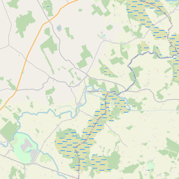
Based on data in OpenStreetMap, here is a list of townlands in Piercetown.
Piercetown ist in den Baronien Rathconrath.
Piercetown ist in den Grafschaften Westmeath.
Piercetown bei Logainm.ie: Piercetown.
Karte
Befindet sich bei 53° 33' 40" N, 7° 37' 14" W.


Leaflet | Map data © OpenStreetMap contributors
Fläche
Piercetown hat eine Fläche von 15,0 km² / 3,695,8 Acres / 5,8 Quadratmeilen.
Townlands
There are 15 townlands that we know about in Piercetown. This represents 100% of all the area in Piercetown.
- Aghnabohy, Gemeinde Piercetown, Baronie Rathconrath, Grafschaft Westmeath 293 A, 1 R, 12 P
- Baile Phiarais (see Piercetown (Baile Phiarais) , Gemeinde Piercetown, Baronie Rathconrath, Grafschaft Westmeath)
- Ballincurra, Gemeinde Piercetown, Baronie Rathconrath, Grafschaft Westmeath 200 A, 0 R, 27 P
- Ballymaglavy, Gemeinde Piercetown, Baronie Rathconrath, Grafschaft Westmeath 803 A, 2 R, 18 P
- Curraghboy, Gemeinde Piercetown, Baronie Rathconrath, Grafschaft Westmeath 264 A, 3 R, 23 P
- Fiveacres, Gemeinde Piercetown, Baronie Rathconrath, Grafschaft Westmeath 70 A, 2 R, 19 P
- Glebe, Gemeinde Piercetown, Baronie Rathconrath, Grafschaft Westmeath 17 A, 3 R, 3 P
- Kilphierish, Gemeinde Piercetown, Baronie Rathconrath, Grafschaft Westmeath 270 A, 0 R, 10 P
- Malthousepark, Gemeinde Piercetown, Baronie Rathconrath, Grafschaft Westmeath 9 A, 2 R, 6 P
- Piercetown (Baile Phiarais) , Gemeinde Piercetown, Baronie Rathconrath, Grafschaft Westmeath 233 A, 0 R, 24 P
- Rath (Malone), Gemeinde Piercetown, Baronie Rathconrath, Grafschaft Westmeath 38 A, 0 R, 5 P
- Rathcogue, Gemeinde Piercetown, Baronie Rathconrath, Grafschaft Westmeath 189 A, 1 R, 18 P
- Relick (Longworth), Gemeinde Piercetown, Baronie Rathconrath, Grafschaft Westmeath 215 A, 3 R, 11 P
- Relick (Malone), Gemeinde Piercetown, Baronie Rathconrath, Grafschaft Westmeath 36 A, 1 R, 34 P
- Williamstown, Gemeinde Piercetown, Baronie Rathconrath, Grafschaft Westmeath 762 A, 1 R, 0 P
- Williamstown New, Gemeinde Piercetown, Baronie Rathconrath, Grafschaft Westmeath 290 A, 2 R, 26 P
 OpenStreetMap
Piercetown wurde am 24 Nov 2014 von brianboru bei OpenStreetMap erfasst.
- View
- Edit

 JOSM
JOSM iD
iD