Based on data in OpenStreetMap, here is a list of townlands in the Electoral Division / ED / District Electoral Division of Newtownards South.
Newtownards South is in Co.
Newtownards South is not matched up to Logainm.ie yet.
Map
It is located at 54° 36' 10" N, 5° 44' 10" W.
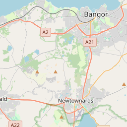
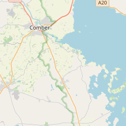
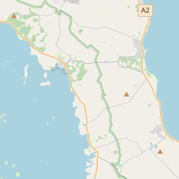
Leaflet | Map data © OpenStreetMap contributors
Area
Newtownards South has an area of 26.8 km² / 6,620.3 acres / 10.3 square miles.
Townlands
There are 16 townlands that we know about in . This represents 100% of all the area in .
- Ballyalton 138 A, 3 R, 19 P
- Ballybarnes 256 A, 0 R, 6 P
- Ballycullen 324 A, 3 R, 19 P
- Ballymagreehan 171 A, 0 R, 28 P
- Ballymoney 446 A, 2 R, 14 P
- Ballyrogan 353 A, 2 R, 11 P
- Ballyskeagh High 711 A, 1 R, 1 P
- Ballyskeagh Low 329 A, 1 R, 19 P
- Commons 224 A, 1 R, 7 P
- Corporation South 737 A, 3 R, 7 P
- Craigogantlet 661 A, 3 R, 28 P
- Greengraves 769 A, 2 R, 37 P
- Killarn 412 A, 0 R, 30 P
- Milecross 405 A, 2 R, 36 P
- Scrabo 320 A, 1 R, 18 P
- Tullynagardy 356 A, 1 R, 35 P
 OpenStreetMap
Newtownards South was added to OpenStreetMap on 21 Feb 2021 by b-unicycling.
- View
- Edit