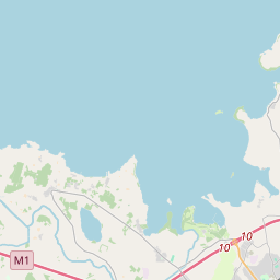
Based on data in OpenStreetMap, here is a list of townlands in Kilmore (Lower Orior portion).
Kilmore (Lower Orior portion) is in the baronies of Orior Lower.
Kilmore (Lower Orior portion) is in the counties of Armagh.
Kilmore (Lower Orior portion) is not matched up to Logainm.ie yet.
Map
It is located at 54° 22' 27" N, 6° 26' 19" W.


Leaflet | Map data © OpenStreetMap contributors
Area
Kilmore (Lower Orior portion) has an area of 20.3 km² / 5,027.8 acres / 7.9 square miles.
Townlands
There are 11 townlands that we know about in Kilmore (Lower Orior portion). This represents 100% of all the area in Kilmore (Lower Orior portion).
- Baile an Lusca (see Ballylisk (Baile an Lusca) , Kilmore (Lower Orior portion) Civil Parish, Barony of Orior Lower, Co. Armagh)
- Baile Cnoic (see Ballyknock (Baile Cnoic) , Kilmore (Lower Orior portion) Civil Parish, Barony of Orior Lower, Co. Armagh)
- Ballyknock (Baile Cnoic) , Kilmore (Lower Orior portion) Civil Parish, Barony of Orior Lower, Co. Armagh 294 A, 2 R, 9 P
- Ballylisk (Baile an Lusca) , Kilmore (Lower Orior portion) Civil Parish, Barony of Orior Lower, Co. Armagh 342 A, 3 R, 7 P
- Brackagh (Breacach) , Kilmore (Lower Orior portion) Civil Parish, Barony of Orior Lower, Co. Armagh 984 A, 0 R, 38 P
- Breacach (see Brackagh (Breacach) , Kilmore (Lower Orior portion) Civil Parish, Barony of Orior Lower, Co. Armagh)
- Cor dtréan (see Cordrain (Cor dtréan) , Kilmore (Lower Orior portion) Civil Parish, Barony of Orior Lower, Co. Armagh)
- Cor na scríbe (see Cornascreeb (Cor na scríbe) , Kilmore (Lower Orior portion) Civil Parish, Barony of Orior Lower, Co. Armagh)
- Cordrain (Cor dtréan) , Kilmore (Lower Orior portion) Civil Parish, Barony of Orior Lower, Co. Armagh 302 A, 3 R, 24 P
- Cornascreeb (Cor na scríbe) , Kilmore (Lower Orior portion) Civil Parish, Barony of Orior Lower, Co. Armagh 653 A, 1 R, 24 P
- Lios an mheidhg (see Lisavague (Lios an mheidhg) , Kilmore (Lower Orior portion) Civil Parish, Barony of Orior Lower, Co. Armagh)
- Lisavague (Lios an mheidhg) , Kilmore (Lower Orior portion) Civil Parish, Barony of Orior Lower, Co. Armagh 333 A, 1 R, 11 P
- Mullach a bhile (see Mullavilly (Mullach a bhile) , Kilmore (Lower Orior portion) Civil Parish, Barony of Orior Lower, Co. Armagh)
- Mullach Uí Aidí (see Mullahead (Mullach Uí Aidí) , Kilmore (Lower Orior portion) Civil Parish, Barony of Orior Lower, Co. Armagh)
- Mullahead (Mullach Uí Aidí) , Kilmore (Lower Orior portion) Civil Parish, Barony of Orior Lower, Co. Armagh 870 A, 0 R, 34 P
- Mullavilly (Mullach a bhile) , Kilmore (Lower Orior portion) Civil Parish, Barony of Orior Lower, Co. Armagh 157 A, 3 R, 27 P
- Tamhnach mór (see Tamnaghmore (Tamhnach mór) , Kilmore (Lower Orior portion) Civil Parish, Barony of Orior Lower, Co. Armagh)
- Tamhnach na bealltainne (see Tamnaghvelton (Tamhnach na bealltainne) , Kilmore (Lower Orior portion) Civil Parish, Barony of Orior Lower, Co. Armagh)
- Tamnaghmore (Tamhnach mór) , Kilmore (Lower Orior portion) Civil Parish, Barony of Orior Lower, Co. Armagh 528 A, 0 R, 6 P
- Tamnaghvelton (Tamhnach na bealltainne) , Kilmore (Lower Orior portion) Civil Parish, Barony of Orior Lower, Co. Armagh 384 A, 1 R, 1 P
- Uinseannach (see Unshinagh (Uinseannach) , Kilmore (Lower Orior portion) Civil Parish, Barony of Orior Lower, Co. Armagh)
- Unshinagh (Uinseannach) , Kilmore (Lower Orior portion) Civil Parish, Barony of Orior Lower, Co. Armagh 176 A, 0 R, 23 P
 OpenStreetMap
Kilmore (Lower Orior portion) was added to OpenStreetMap on 14 Aug 2016 by Stephen_Co_Antrim.
- View
- Edit

 JOSM
JOSM iD
iD