Based on data in OpenStreetMap, here is a list of townlands in the Electoral Division / ED / District Electoral Division of Termon.
Termon is in Co.
Termon is not matched up to Logainm.ie yet.
Map
It is located at 53° 53' 50" N, 7° 7' 58" W.
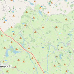
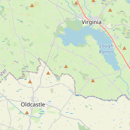


Leaflet | Map data © OpenStreetMap contributors
Area
Termon has an area of 19.5 km² / 4,813.8 acres / 7.5 square miles.
Townlands
There are 14 townlands that we know about in . This represents 100% of all the area in .
- Assan 139 A, 1 R, 1 P
- Billis 289 A, 0 R, 5 P
- Carrickeeshil 297 A, 0 R, 21 P
- Corraneden 173 A, 1 R, 5 P
- Drumederglass 96 A, 1 R, 9 P
- Drumfomina 266 A, 3 R, 33 P
- Drummallaght 740 A, 2 R, 1 P
- Killyduff 199 A, 1 R, 13 P
- Lateaster 122 A, 0 R, 24 P
- Lissacapple 186 A, 1 R, 22 P
- Lissannymore 762 A, 0 R, 28 P
- Lurgananure 335 A, 2 R, 21 P
- Termon 758 A, 0 R, 25 P
- Tievenaman 447 A, 1 R, 25 P
 OpenStreetMap
Termon was added to OpenStreetMap on 14 Feb 2017 by PaddyMatthews.
- View
- Edit