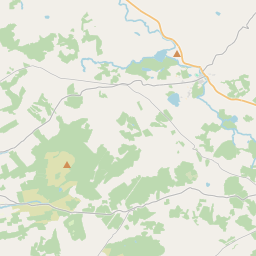
Based on data in OpenStreetMap, here is a list of townlands in the Electoral Division / ED / District Electoral Division of Corrofin.
Corrofin is in Co.
Corrofin is not matched up to Logainm.ie yet.
Map
It is located at 52° 56' 57" N, 9° 3' 12" W.


Leaflet | Map data © OpenStreetMap contributors
Area
Corrofin has an area of 34.2 km² / 8,440.0 acres / 13.2 square miles.
Townlands
There are 34 townlands that we know about in . This represents 100.0% of all the area in .
- Annagh 67 A, 3 R, 24 P
- Anneville 98 A, 1 R, 10 P
- Ballykinnacorra North 240 A, 3 R, 5 P
- Ballykinnacorra South 146 A, 1 R, 22 P
- Ballyporty North 455 A, 2 R, 15 P
- Ballyporty South 284 A, 1 R, 2 P
- Baunkyle 465 A, 0 R, 35 P
- Caherbullaun 407 A, 1 R, 2 P
- Cahercorcaun 145 A, 2 R, 21 P
- Cahernamona 43 A, 0 R, 35 P
- Carnaun 146 A, 2 R, 3 P
- Coad 428 A, 2 R, 12 P
- Cregmoher 335 A, 2 R, 17 P
- Curraghkeel 107 A, 2 R, 31 P
- Dabrian 72 A, 0 R, 6 P
- Garryncallaha 108 A, 0 R, 21 P
- Gortcooldurrin 88 A, 2 R, 20 P
- Inchiquin 294 A, 0 R, 34 P
- Islandmore 133 A, 2 R, 1 P
- Kells 747 A, 3 R, 39 P
- Killeen 412 A, 1 R, 5 P
- Killeen 157 A, 2 R, 35 P
- Kilvoydan 171 A, 0 R, 19 P
- Laghtagoona 271 A, 3 R, 28 P
- Liscullaun 132 A, 0 R, 31 P
- Lisduff 256 A, 3 R, 31 P
- Poulbaun 126 A, 0 R, 22 P
- Rath 219 A, 1 R, 0 P
- Rinroe 194 A, 3 R, 13 P
- Roxton 452 A, 1 R, 11 P
- Scool 289 A, 3 R, 5 P
- Shandangan 320 A, 1 R, 20 P
- Shessiv 174 A, 1 R, 36 P
- Turkenagh 443 A, 0 R, 18 P
 OpenStreetMap
Corrofin was added to OpenStreetMap on 17 Dec 2016 by Teester.
- View
- Edit

 JOSM
JOSM iD
iD