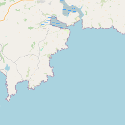
Based on data in OpenStreetMap, here is a list of townlands in the Electoral Division / ED / District Electoral Division of Ardfield.
Ardfield is in Co.
Ardfield is not matched up to Logainm.ie yet.
Map
It is located at 51° 34' 25" N, 8° 54' 25" W.


Leaflet | Map data © OpenStreetMap contributors
Area
Ardfield has an area of 18.0 km² / 4,439.6 acres / 6.9 square miles.
Townlands
There are 31 townlands that we know about in . This represents 100% of all the area in .
- Ahagilla 110 A, 3 R, 30 P
- Ballyluck 184 A, 2 R, 8 P
- Ballyva 210 A, 3 R, 11 P
- Balteenbrack 91 A, 3 R, 4 P
- Brittas 14 A, 1 R, 32 P
- Brownstown 252 A, 3 R, 11 P
- Caher 135 A, 0 R, 30 P
- Caherlarhig 197 A, 1 R, 4 P
- Camus 368 A, 1 R, 3 P
- Carhoo 32 A, 0 R, 3 P
- Clonlea 132 A, 0 R, 24 P
- Clooncunnig 117 A, 0 R, 28 P
- Corrabally 252 A, 3 R, 8 P
- Creboy 77 A, 2 R, 20 P
- Dairies 8 A, 2 R, 23 P
- Drombeg 81 A, 1 R, 34 P
- Duneen 210 A, 2 R, 15 P
- Dunmore 229 A, 1 R, 34 P
- Dunnycove 119 A, 0 R, 26 P
- Dunowen 654 A, 0 R, 30 P
- Farran 89 A, 3 R, 18 P
- Garrymore 64 A, 3 R, 9 P
- Greenanes 15 A, 0 R, 14 P
- Greenfield 45 A, 0 R, 3 P
- Little Island 48 A, 3 R, 3 P
- Lonagh 34 A, 0 R, 28 P
- Moneennamucky 100 A, 1 R, 20 P
- Mountain Common 323 A, 0 R, 32 P
- Muckruss 102 A, 2 R, 3 P
- Pallas 104 A, 3 R, 6 P
- Rineen 29 A, 2 R, 14 P
 OpenStreetMap
Ardfield was added to OpenStreetMap on 19 Jan 2017 by Teester.
- View
- Edit

 JOSM
JOSM iD
iD