Based on data in OpenStreetMap, here is a list of townlands in the Electoral Division / ED / District Electoral Division of Fahan.
Fahan is in Co.
Fahan is not matched up to Logainm.ie yet.
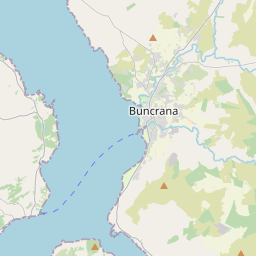
Map
It is located at 55° 5' 8" N, 7° 25' 39" W.


Leaflet | Map data © OpenStreetMap contributors
Area
Fahan has an area of 30.1 km² / 7,429.1 acres / 11.6 square miles.
Townlands
There are 19 townlands that we know about in . This represents 100% of all the area in .
- Annaslee 319 A, 2 R, 35 P
- Ballynahone 1087 A, 2 R, 17 P
- Carnashannagh 273 A, 1 R, 1 P
- Carrontlieve 147 A, 0 R, 1 P
- Carrowmullin 332 A, 1 R, 35 P
- Castlequarter 110 A, 0 R, 22 P
- Craigtown 197 A, 0 R, 36 P
- Crislaghkeel 543 A, 1 R, 4 P
- Crislaghmore 521 A, 1 R, 24 P
- Figary 177 A, 1 R, 14 P
- Glebe 8 A, 3 R, 37 P
- Glebe Large 59 A, 3 R, 16 P
- Inch Level 348 A, 2 R, 36 P
- Letter 616 A, 2 R, 12 P
- Lisfannon 585 A, 0 R, 1 P
- Magherabeg 347 A, 3 R, 15 P
- Monreagh 923 A, 0 R, 3 P
- Roosky 375 A, 2 R, 2 P
- Tievebane 454 A, 0 R, 12 P
 OpenStreetMap
Fahan was added to OpenStreetMap on 25 Apr 2016 by NoelB.
- View
- Edit

 JOSM
JOSM iD
iD