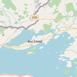
Based on data in OpenStreetMap, here is a list of townlands in the Electoral Division / ED / District Electoral Division of Monea.
Monea is in Co.
Monea is not matched up to Logainm.ie yet.
Map
It is located at 54° 23' 29" N, 7° 46' 36" W.


Leaflet | Map data © OpenStreetMap contributors
Area
Monea has an area of 16.1 km² / 3,968.6 acres / 6.2 square miles.
Townlands
There are 23 townlands that we know about in . This represents 100% of all the area in .
- Carran East 181 A, 3 R, 6 P
- Castletown Monea 142 A, 0 R, 5 P
- Cleens Old 55 A, 0 R, 34 P
- Derryvary Beg 203 A, 3 R, 12 P
- Derryvary More 207 A, 3 R, 14 P
- Drumaveel 111 A, 0 R, 3 P
- Drumbeggan 299 A, 0 R, 9 P
- Drumcorban 112 A, 0 R, 17 P
- Drumcroohen 131 A, 0 R, 24 P
- Drumlish 163 A, 2 R, 39 P
- Drumscollop 291 A, 2 R, 33 P
- Fartagh 92 A, 0 R, 7 P
- Gillyholme (L’Estrange) 122 A, 1 R, 38 P
- Giltagh 108 A, 3 R, 4 P
- Killyveagh Glebe 327 A, 3 R, 33 P
- Leighan 337 A, 3 R, 21 P
- Magheranageeragh 102 A, 3 R, 12 P
- Monea 155 A, 0 R, 1 P
- Newtown 170 A, 2 R, 16 P
- Randalshough 140 A, 3 R, 15 P
- Tullycreevy 242 A, 2 R, 24 P
- Tullykelter 103 A, 3 R, 34 P
- Tullymargy 163 A, 3 R, 36 P
 OpenStreetMap
Monea was added to OpenStreetMap on 5 Oct 2020 by brianh.
- View
- Edit

 JOSM
JOSM iD
iD