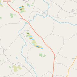
Based on data in OpenStreetMap, here is a list of townlands in the Electoral Division / ED / District Electoral Division of Milltown.
Milltown is in Co.
Milltown is not matched up to Logainm.ie yet.
Map
It is located at 53° 37' 52" N, 8° 55' 11" W.


Leaflet | Map data © OpenStreetMap contributors
Area
Milltown has an area of 28.0 km² / 6,915.1 acres / 10.8 square miles.
Townlands
There are 27 townlands that we know about in . This represents 100% of all the area in .
- Ballymary 39 A, 3 R, 24 P
- Bellaconeen 56 A, 3 R, 21 P
- Carrownageeha 241 A, 0 R, 20 P
- Carrownurlaur 1583 A, 3 R, 18 P
- Cartron 147 A, 3 R, 12 P
- Cloondroon 359 A, 2 R, 17 P
- Cloonnacross 154 A, 2 R, 26 P
- Cloonrane 474 A, 1 R, 18 P
- Cooladooaun 154 A, 2 R, 11 P
- Coollicknalea 316 A, 1 R, 0 P
- Cormeelick North 104 A, 0 R, 27 P
- Cormeelick South 88 A, 2 R, 23 P
- Curraghaderry 280 A, 0 R, 32 P
- Dalgin 202 A, 2 R, 14 P
- Dawros Lower 102 A, 1 R, 11 P
- Dawros Upper 186 A, 1 R, 39 P
- Drum 282 A, 1 R, 29 P
- Gortnagunned 208 A, 1 R, 18 P
- Gortnaloura 63 A, 0 R, 6 P
- Illaun 300 A, 2 R, 10 P
- Killerneen 137 A, 1 R, 10 P
- Knockaunkeel 34 A, 3 R, 23 P
- Lack 166 A, 1 R, 28 P
- Milltown 103 A, 0 R, 7 P
- Pollaturick 264 A, 0 R, 5 P
- Russelstown 661 A, 1 R, 18 P
- Ummeracly East 200 A, 0 R, 23 P
 OpenStreetMap
Milltown was added to OpenStreetMap on 13 Dec 2016 by Boggedy.
- View
- Edit

 JOSM
JOSM iD
iD