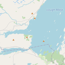
Based on data in OpenStreetMap, here is a list of townlands in the Electoral Division / ED / District Electoral Division of Portroyal.
Portroyal is in Co.
Portroyal is not matched up to Logainm.ie yet.
Map
It is located at 53° 41' 6" N, 9° 17' 36" W.


Leaflet | Map data © OpenStreetMap contributors
Area
Portroyal has an area of 45.4 km² / 11,217.8 acres / 17.5 square miles.
Townlands
There are 27 townlands that we know about in . This represents 61.6% of all the area in .
- Aghinish 475 A, 0 R, 34 P
- Ballygarry 133 A, 2 R, 33 P
- Ballynanerroon Beg 76 A, 3 R, 33 P
- Ballynanerroon More 282 A, 1 R, 6 P
- Ballynaslee 102 A, 0 R, 27 P
- Bonniamillish Island 5 A, 0 R, 36 P
- Carrowaneeragh 315 A, 2 R, 3 P
- Carrowmoney 286 A, 0 R, 8 P
- Cloonee 451 A, 3 R, 34 P
- Cloonlagheen 428 A, 0 R, 4 P
- Derradda 228 A, 1 R, 24 P
- Derrew 451 A, 1 R, 10 P
- Derrymore 261 A, 3 R, 17 P
- Furnace 224 A, 1 R, 5 P
- Gallagh 173 A, 2 R, 20 P
- Illan Columbkille 10 A, 3 R, 1 P
- Kilfaul 386 A, 2 R, 32 P
- Knockaleanore 109 A, 0 R, 9 P
- Knocknagool 158 A, 3 R, 15 P
- Leamnahye Island 3 A, 2 R, 21 P
- Long Island 21 A, 2 R, 10 P
- Newtown 517 A, 0 R, 15 P
- Pig Island 12 A, 0 R, 24 P
- Portroyal 451 A, 1 R, 8 P
- River Island 15 A, 1 R, 15 P
- Srah 968 A, 2 R, 16 P
- Tooreen 363 A, 3 R, 17 P
 OpenStreetMap
Portroyal was added to OpenStreetMap on 10 Dec 2016 by Boggedy.
- View
- Edit

 JOSM
JOSM iD
iD