Based on data in OpenStreetMap, here is a list of townlands in Athnid.
Athnid is in the baronies of Eliogarty.
Athnid is in the counties of Tipperary.
Athnid is on Logainm.ie: Athnid.
Map
It is located at 52° 43' 21" N, 7° 46' 13" W.
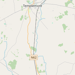

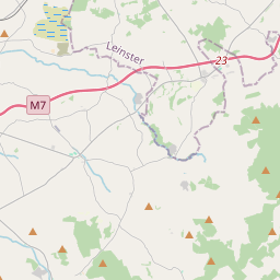

Leaflet | Map data © OpenStreetMap contributors
Area
Athnid has an area of 3.5 km² / 858.9 acres / 1.3 square miles.
Townlands
There are 2 townlands that we know about in Athnid. This represents 100% of all the area in Athnid.
- Áth Nid Beag (see Athnid Beg (Áth Nid Beag) , Athnid Civil Parish, Barony of Eliogarty, Co. Tipperary)
- Áth Nid Mór (see Athnid More (Áth Nid Mór) , Athnid Civil Parish, Barony of Eliogarty, Co. Tipperary)
- Athnid Beg (Áth Nid Beag) , Athnid Civil Parish, Barony of Eliogarty, Co. Tipperary 215 A, 2 R, 24 P
- Athnid More (Áth Nid Mór) , Athnid Civil Parish, Barony of Eliogarty, Co. Tipperary 643 A, 0 R, 37 P
 OpenStreetMap
Athnid was added to OpenStreetMap on 19 Jul 2016 by Teester.
- View
- Edit