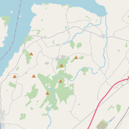
Based on data in OpenStreetMap, here is a list of townlands in the Electoral Division / ED / District Electoral Division of Monsea.
Monsea is in Co.
Monsea is not matched up to Logainm.ie yet.
Map
It is located at 52° 54' 28" N, 8° 16' 58" W.


Leaflet | Map data © OpenStreetMap contributors
Area
Monsea has an area of 23.0 km² / 5,694.2 acres / 8.9 square miles.
Townlands
There are 20 townlands that we know about in . This represents 73.5% of all the area in .
- Annaghbeg 240 A, 1 R, 12 P
- Ardgregane 156 A, 1 R, 11 P
- Ballyartella 287 A, 3 R, 18 P
- Ballydrinan 188 A, 0 R, 15 P
- Carrick 160 A, 3 R, 39 P
- Carrow 302 A, 3 R, 16 P
- Castlesheela 80 A, 0 R, 29 P
- Corraquill 59 A, 2 R, 24 P
- Crannagh 274 A, 0 R, 21 P
- Cushmona 146 A, 3 R, 10 P
- Dromineer 279 A, 1 R, 37 P
- Garraunfadda 329 A, 3 R, 18 P
- Garryduff 64 A, 3 R, 0 P
- Gortanoura 54 A, 1 R, 5 P
- Gortyogan 96 A, 0 R, 21 P
- Killaun 347 A, 3 R, 9 P
- Monsea 705 A, 2 R, 34 P
- Shannonhall 109 A, 2 R, 30 P
- Shannonvale 187 A, 0 R, 22 P
- Tomona 113 A, 2 R, 25 P
 OpenStreetMap
Monsea was added to OpenStreetMap on 8 Dec 2016 by Teester.
- View
- Edit

 JOSM
JOSM iD
iD