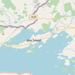
Based on data in OpenStreetMap, here is a list of townlands in the Electoral Division / ED / District Electoral Division of Lisnarrick.
Lisnarrick is in Co.
Lisnarrick is not matched up to Logainm.ie yet.
Map
It is located at 54° 27' 47" N, 7° 42' 38" W.


Leaflet | Map data © OpenStreetMap contributors
Area
Lisnarrick has an area of 10.5 km² / 2,593.6 acres / 4.1 square miles.
Townlands
There are 21 townlands that we know about in . This represents 100% of all the area in .
- Doonan 188 A, 3 R, 26 P
- Drumaran 49 A, 3 R, 5 P
- Drumarky 177 A, 1 R, 17 P
- Drumhoney 205 A, 2 R, 12 P
- Drummal 198 A, 3 R, 12 P
- Drummonaghan 95 A, 1 R, 39 P
- Drumpeen 88 A, 3 R, 21 P
- Drumshane 195 A, 0 R, 36 P
- Duross 228 A, 0 R, 0 P
- Gaffer Island 11 A, 1 R, 23 P
- Glenross 163 A, 0 R, 10 P
- Gull Rock 3 A, 0 R, 29 P
- Inish Conra 11 A, 2 R, 4 P
- Inish Davar 25 A, 2 R, 26 P
- Isle Namanfin 5 A, 2 R, 38 P
- Lignameeltoge 156 A, 3 R, 39 P
- Liscreevin 196 A, 3 R, 0 P
- Mullies 143 A, 0 R, 8 P
- Mullybrack 44 A, 3 R, 18 P
- Rossgweer 306 A, 2 R, 34 P
- Rossigh 96 A, 2 R, 2 P
 OpenStreetMap
Lisnarrick was added to OpenStreetMap on 13 Feb 2021 by brianh.
- View
- Edit

 JOSM
JOSM iD
iD