Based on data in OpenStreetMap, here is a list of townlands in Killevy (Lower Orior portion).
Killevy (Lower Orior portion) fait partie des baronnies de Orior Lower.
Killevy (Lower Orior portion) fait partie des comtés de Armagh.
Killevy (Lower Orior portion) is not matched up to Logainm.ie yet.
Carte
Il est situé à 54° 14' 4" N, 6° 23' 31" W.
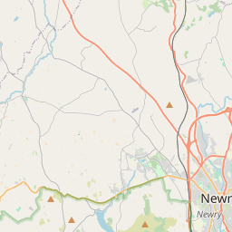
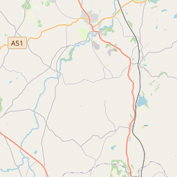
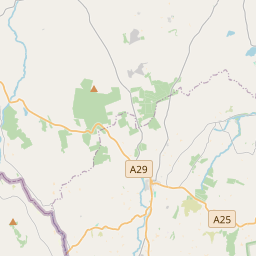
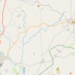
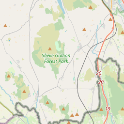
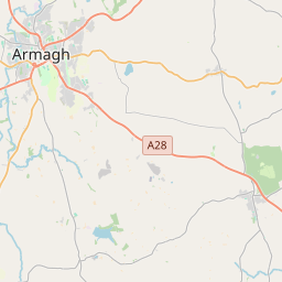
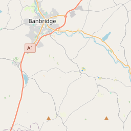
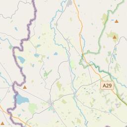
Leaflet | Map data © OpenStreetMap contributors
Superficie
Killevy (Lower Orior portion) a une superficie de 16,1 km² / 3,976,3 acres / 6,2 miles carrés.
Townlands
There are 12 townlands that we know about in Killevy (Lower Orior portion). This represents 100% of all the area in Killevy (Lower Orior portion).
- Baile Mhic Raincín (see Crankey (Baile Mhic Raincín) , Paroisse civile Killevy (Lower Orior portion), Baronnie de Orior Lower, Comté Armagh)
- Baile na Saoirseach (see Serse (Baile na Saoirseach) , Paroisse civile Killevy (Lower Orior portion), Baronnie de Orior Lower, Comté Armagh)
- Cnoc Dubh (see Knockduff (Cnoc Dubh) , Paroisse civile Killevy (Lower Orior portion), Baronnie de Orior Lower, Comté Armagh)
- Coill Manachain (see Kilmonaghan (Coill Manachain) , Paroisse civile Killevy (Lower Orior portion), Baronnie de Orior Lower, Comté Armagh)
- Coill na mBodach (see Killybodagh (Coill na mBodach) , Paroisse civile Killevy (Lower Orior portion), Baronnie de Orior Lower, Comté Armagh)
- Coill righ (see Kilrea (Coill righ) , Paroisse civile Killevy (Lower Orior portion), Baronnie de Orior Lower, Comté Armagh)
- Cor-fhuinnseoige (see Corrinshigo (Cor-fhuinnseoige) , Paroisse civile Killevy (Lower Orior portion), Baronnie de Orior Lower, Comté Armagh)
- Corrinshigo (Cor-fhuinnseoige) , Paroisse civile Killevy (Lower Orior portion), Baronnie de Orior Lower, Comté Armagh 398 A, 3 R, 30 P
- Crankey (Baile Mhic Raincín) , Paroisse civile Killevy (Lower Orior portion), Baronnie de Orior Lower, Comté Armagh 142 A, 1 R, 22 P
- Druim Beannchair (see Drumbanagher (Druim Beannchair) , Paroisse civile Killevy (Lower Orior portion), Baronnie de Orior Lower, Comté Armagh)
- Drumbanagher (Druim Beannchair) , Paroisse civile Killevy (Lower Orior portion), Baronnie de Orior Lower, Comté Armagh 284 A, 3 R, 12 P
- Eanach (see Enagh (Eanach) , Paroisse civile Killevy (Lower Orior portion), Baronnie de Orior Lower, Comté Armagh)
- Enagh (Eanach) , Paroisse civile Killevy (Lower Orior portion), Baronnie de Orior Lower, Comté Armagh 166 A, 0 R, 33 P
- Killybodagh (Coill na mBodach) , Paroisse civile Killevy (Lower Orior portion), Baronnie de Orior Lower, Comté Armagh 378 A, 0 R, 11 P
- Kilmonaghan (Coill Manachain) , Paroisse civile Killevy (Lower Orior portion), Baronnie de Orior Lower, Comté Armagh 181 A, 2 R, 37 P
- Kilrea (Coill righ) , Paroisse civile Killevy (Lower Orior portion), Baronnie de Orior Lower, Comté Armagh 301 A, 1 R, 21 P
- Knockduff (Cnoc Dubh) , Paroisse civile Killevy (Lower Orior portion), Baronnie de Orior Lower, Comté Armagh 184 A, 0 R, 33 P
- Lesh (An Lios) , Paroisse civile Killevy (Lower Orior portion), Baronnie de Orior Lower, Comté Armagh 195 A, 3 R, 6 P
- An Lios (see Lesh (An Lios) , Paroisse civile Killevy (Lower Orior portion), Baronnie de Orior Lower, Comté Armagh)
- Lios Sughmoinni (see Lissummon (Lios Sughmoinni) , Paroisse civile Killevy (Lower Orior portion), Baronnie de Orior Lower, Comté Armagh)
- Lissummon (Lios Sughmoinni) , Paroisse civile Killevy (Lower Orior portion), Baronnie de Orior Lower, Comté Armagh 567 A, 2 R, 6 P
- Serse (Baile na Saoirseach) , Paroisse civile Killevy (Lower Orior portion), Baronnie de Orior Lower, Comté Armagh 440 A, 3 R, 24 P
- Tulaigh Cheapaí (see Tullyhappy (Tulaigh Cheapaí) , Paroisse civile Killevy (Lower Orior portion), Baronnie de Orior Lower, Comté Armagh)
- Tullyhappy (Tulaigh Cheapaí) , Paroisse civile Killevy (Lower Orior portion), Baronnie de Orior Lower, Comté Armagh 734 A, 1 R, 2 P
 OpenStreetMap
Killevy (Lower Orior portion) a été ajouté à OpenStreetMap le 14 Aoû 2016 par Stephen_Co_Antrim.
- View
- Edit