Based on data in OpenStreetMap, here is a list of townlands in the Electoral Division / ED / District Electoral Division of Tartaraghan.
Tartaraghan est dans le Comté
Tartaraghan is not matched up to Logainm.ie yet.
Carte
Il est situé à 54° 29' 13" N, 6° 32' 8" W.
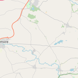

Leaflet | Map data © OpenStreetMap contributors
Superficie
Tartaraghan a une superficie de 23,6 km² / 5,839,1 acres / 9,1 miles carrés.
Townlands
Il y a 15 townlands connus dans , soit 99,8% de la superficie de .
- Ballynarry 616 A, 2 R, 37 P
- Breagh 352 A, 0 R, 32 P
- Cloncarrish 180 A, 1 R, 37 P
- Cloncore 558 A, 1 R, 25 P
- Clonmakate 307 A, 3 R, 32 P
- Clontylew 149 A, 3 R, 14 P
- Derrinraw 896 A, 1 R, 38 P
- Derryaugh 207 A, 0 R, 30 P
- Derrycaw 270 A, 0 R, 7 P
- Derrykeeran 384 A, 0 R, 20 P
- Derrykeevan 277 A, 2 R, 14 P
- Derrylard 673 A, 2 R, 9 P
- Derrylileagh 429 A, 1 R, 26 P
- Maghery 404 A, 2 R, 15 P
- Tarthlogue 119 A, 0 R, 35 P
 OpenStreetMap
Tartaraghan a été ajouté à OpenStreetMap le 24 Fév 2021 par b-unicycling.
- View
- Edit