Based on data in OpenStreetMap, here is a list of townlands in the Electoral Division / ED / District Electoral Division of Moy.
Moy est dans le Comté
Moy is not matched up to Logainm.ie yet.
Carte
Il est situé à 52° 53' 58" N, 9° 20' 11" W.

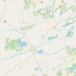
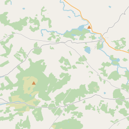
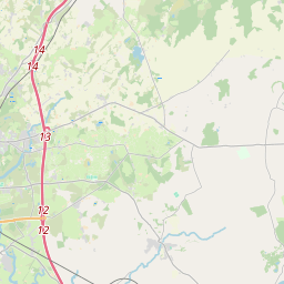
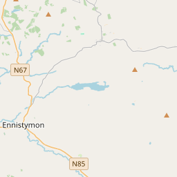
Leaflet | Map data © OpenStreetMap contributors
Superficie
Moy a une superficie de 26,0 km² / 6,426,4 acres / 10,0 miles carrés.
Townlands
Il y a 21 townlands connus dans , soit 100% de la superficie de .
- Ailbrack 170 A, 3 R, 20 P
- Attycristora 287 A, 2 R, 6 P
- Calluragh South 303 A, 1 R, 0 P
- Carrowgar 278 A, 3 R, 4 P
- Carrowntedaun 507 A, 0 R, 7 P
- Clooneybreen 73 A, 2 R, 3 P
- Clooneyogan North 251 A, 3 R, 34 P
- Clooneyogan South 359 A, 0 R, 6 P
- Crag 210 A, 3 R, 5 P
- Fahanlunaghta Beg 257 A, 1 R, 26 P
- Fahanlunaghta More 207 A, 1 R, 11 P
- Illaunbaun 418 A, 2 R, 16 P
- Lackamore 473 A, 1 R, 25 P
- Maghera 326 A, 1 R, 13 P
- Moy beg 303 A, 3 R, 3 P
- Moy More 209 A, 3 R, 8 P
- Rinneen 414 A, 0 R, 33 P
- Toor 396 A, 1 R, 15 P
- Tooreen 460 A, 1 R, 18 P
- Tullygarvan East 207 A, 3 R, 4 P
- Tullygarvan West 308 A, 0 R, 32 P
 OpenStreetMap
Moy a été ajouté à OpenStreetMap le 16 Déc 2016 par Teester.
- View
- Edit