Based on data in OpenStreetMap, here is a list of townlands in the Electoral Division / ED / District Electoral Division of Boulteen.
Boulteen est dans le Comté
Boulteen is not matched up to Logainm.ie yet.
Carte
Il est situé à 51° 42' 44" N, 8° 52' 33" W.

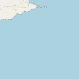
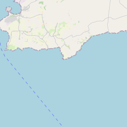


Leaflet | Map data © OpenStreetMap contributors
Superficie
Boulteen a une superficie de 21,3 km² / 5,256,8 acres / 8,2 miles carrés.
Townlands
Il y a 20 townlands connus dans , soit 100% de la superficie de .
- Aghyoghil Beg 95 A, 2 R, 4 P
- Aghyoghil More 179 A, 0 R, 39 P
- Ardkitt East 286 A, 0 R, 22 P
- Ardkitt West 406 A, 2 R, 32 P
- Boulteen 211 A, 3 R, 33 P
- Breaghna 333 A, 2 R, 4 P
- Carrigroe 276 A, 2 R, 39 P
- Drombofinny 85 A, 3 R, 34 P
- Farrannasheshery 306 A, 0 R, 35 P
- Garranelahan 134 A, 0 R, 16 P
- Kilnameela 397 A, 2 R, 12 P
- Kilrush 190 A, 0 R, 35 P
- Knockmacool 243 A, 0 R, 0 P
- Knocknastooka 121 A, 1 R, 0 P
- Lisnacunna 520 A, 1 R, 29 P
- Maulbrack East 100 A, 0 R, 29 P
- Maulbrack West 243 A, 2 R, 10 P
- Maulnarouga North 82 A, 0 R, 10 P
- Maulnarouga South 375 A, 2 R, 23 P
- Tullymurrihy 666 A, 2 R, 27 P
 OpenStreetMap
Boulteen a été ajouté à OpenStreetMap le 20 Jan 2017 par Teester.
- View
- Edit