Based on data in OpenStreetMap, here is a list of townlands in Inch.
Inch fait partie des baronnies de Inishowen West.
Inch fait partie des comtés de Donegal.
Inch est sur Logainm.ie: Inch.
Carte
Il est situé à 55° 3' 58" N, 7° 29' 47" W.
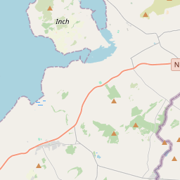
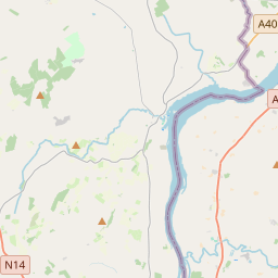
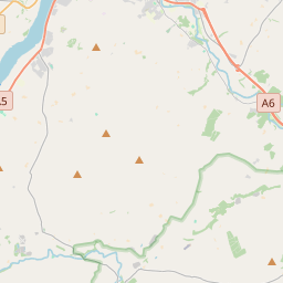
Leaflet | Map data © OpenStreetMap contributors
Superficie
Inch a une superficie de 12,8 km² / 3,156,9 acres / 4,9 miles carrés.
Townlands
There are 8 townlands that we know about in Inch. This represents 100% of all the area in Inch.
- Baile Mhic Cearnachain (see Carnaghan (Baile Mhic Cearnachain) , Paroisse civile Inch, Baronnie de Inishowen West, Comté Donegal)
- Ballynakilly, Paroisse civile Inch, Baronnie de Inishowen West, Comté Donegal 695 A, 2 R, 14 P
- Baylet (Béalad) , Paroisse civile Inch, Baronnie de Inishowen West, Comté Donegal 264 A, 0 R, 3 P
- Béalad (see Baylet (Béalad) , Paroisse civile Inch, Baronnie de Inishowen West, Comté Donegal)
- Bohullion (see Glack (aka Bohullion) , Paroisse civile Inch, Baronnie de Inishowen West, Comté Donegal)
- Carnaghan (Baile Mhic Cearnachain) , Paroisse civile Inch, Baronnie de Inishowen West, Comté Donegal 308 A, 0 R, 12 P
- Carrickanee, Paroisse civile Inch, Baronnie de Inishowen West, Comté Donegal 318 A, 2 R, 6 P
- Castle Quarter (Ceathru an Chasileain) , Paroisse civile Inch, Baronnie de Inishowen West, Comté Donegal 295 A, 1 R, 6 P
- Ceathru an Chasileain (see Castle Quarter (Ceathru an Chasileain) , Paroisse civile Inch, Baronnie de Inishowen West, Comté Donegal)
- Glack (aka Bohullion) , Paroisse civile Inch, Baronnie de Inishowen West, Comté Donegal 593 A, 2 R, 10 P
- Grange, Paroisse civile Inch, Baronnie de Inishowen West, Comté Donegal 371 A, 2 R, 22 P
- Moress, Paroisse civile Inch, Baronnie de Inishowen West, Comté Donegal 310 A, 0 R, 30 P
 OpenStreetMap
Inch a été ajouté à OpenStreetMap le 9 Sep 2015 par Stephen_Co_Antrim.
- View
- Edit