Based on data in OpenStreetMap, here is a list of townlands in the Electoral Division / ED / District Electoral Division of Moira.
Moira est dans le Comté
Moira is not matched up to Logainm.ie yet.
Carte
Il est situé à 54° 28' 4" N, 6° 12' 17" W.
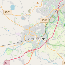
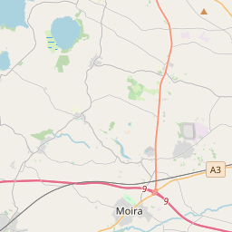

Leaflet | Map data © OpenStreetMap contributors
Superficie
Moira a une superficie de 29,7 km² / 7,337,6 acres / 11,5 miles carrés.
Townlands
Il y a 26 townlands connus dans , soit 100% de la superficie de .
- Aughnadrumman 135 A, 3 R, 22 P
- Aughnafosker 138 A, 0 R, 16 P
- Balloonigan 155 A, 1 R, 0 P
- Ballycanal 137 A, 3 R, 14 P
- Ballygowan 506 A, 0 R, 24 P
- Ballyknock 1203 A, 3 R, 32 P
- Ballymacbrennan 285 A, 2 R, 1 P
- Ballymagaraghan 556 A, 1 R, 10 P
- Bottier 468 A, 2 R, 37 P
- Carnalbanagh East 34 A, 3 R, 34 P
- Carnalbanagh West 19 A, 2 R, 30 P
- Clare 129 A, 3 R, 26 P
- Derrydrumult 162 A, 2 R, 34 P
- Drumbane 180 A, 2 R, 26 P
- Edenmore 242 A, 0 R, 9 P
- Feney 185 A, 2 R, 26 P
- Gartross 237 A, 3 R, 37 P
- Gortnamony 205 A, 1 R, 25 P
- Kilminioge 196 A, 0 R, 18 P
- Legmore 169 A, 1 R, 14 P
- Lurganville 601 A, 0 R, 35 P
- Magherahinch 133 A, 0 R, 33 P
- Risk 308 A, 2 R, 5 P
- Taughlumny 273 A, 3 R, 25 P
- Tullyard 369 A, 2 R, 15 P
- Tullyloob 298 A, 3 R, 16 P
 OpenStreetMap
Moira a été ajouté à OpenStreetMap le 20 Fév 2021 par b-unicycling.
- View
- Edit