Based on data in OpenStreetMap, here is a list of townlands in Drumacoo.
Drumacoo fait partie des baronnies de Dunkellin.
Drumacoo fait partie des comtés de Galway.
Drumacoo est sur Logainm.ie: Drumacoo.
Carte
Il est situé à 53° 11' 41" N, 8° 55' 15" W.
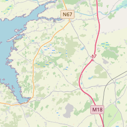
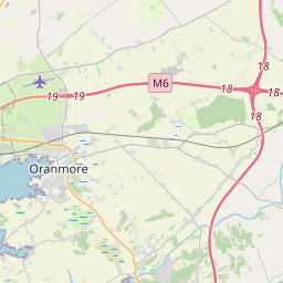
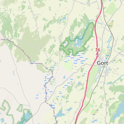
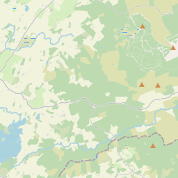
Leaflet | Map data © OpenStreetMap contributors
Superficie
Drumacoo a une superficie de 8,0 km² / 1,977,7 acres / 3,1 miles carrés.
Townlands
There are 13 townlands that we know about in Drumacoo. This represents 100% of all the area in Drumacoo.
- Baile An Doirín (see Ballinderreen (Baile An Doirín) , Paroisse civile Drumacoo, Baronnie de Dunkellin, Comté Galway)
- Baile Uí Mhaoláin (see Ballyvullaun (Baile Uí Mhaoláin) , Paroisse civile Drumacoo, Baronnie de Dunkellin, Comté Galway)
- Ballinderreen (Baile An Doirín) , Paroisse civile Drumacoo, Baronnie de Dunkellin, Comté Galway 185 A, 1 R, 17 P
- Ballyvullaun (Baile Uí Mhaoláin) , Paroisse civile Drumacoo, Baronnie de Dunkellin, Comté Galway 200 A, 0 R, 20 P
- Carrownacreggaun (Ceann an Chreagáin) , Paroisse civile Drumacoo, Baronnie de Dunkellin, Comté Galway 124 A, 0 R, 5 P
- Cartron (An Cartrún) , Paroisse civile Drumacoo, Baronnie de Dunkellin, Comté Galway 150 A, 2 R, 24 P
- An Cartrún (see Cartron (An Cartrún) , Paroisse civile Drumacoo, Baronnie de Dunkellin, Comté Galway)
- Ceann an Chreagáin (see Carrownacreggaun (Ceann an Chreagáin) , Paroisse civile Drumacoo, Baronnie de Dunkellin, Comté Galway)
- Coillín Árann (see Killeenaran (Coillín Árann) , Paroisse civile Drumacoo, Baronnie de Dunkellin, Comté Galway)
- An Croisín (see Crosheen (An Croisín) , Paroisse civile Drumacoo, Baronnie de Dunkellin, Comté Galway)
- Crosheen (An Croisín) , Paroisse civile Drumacoo, Baronnie de Dunkellin, Comté Galway 181 A, 3 R, 35 P
- Droim Mucú (see Drumacoo (Droim Mucú) , Paroisse civile Drumacoo, Baronnie de Dunkellin, Comté Galway)
- Drumacoo (Droim Mucú) , Paroisse civile Drumacoo, Baronnie de Dunkellin, Comté Galway 229 A, 1 R, 32 P
- Fiddaun Island (Oileán an Fheadáin) , Paroisse civile Drumacoo, Baronnie de Dunkellin, Comté Galway 5 A, 3 R, 30 P
- Illaunacrusha (Oileán na Croise) , Paroisse civile Drumacoo, Baronnie de Dunkellin, Comté Galway 1 A, 1 R, 0 P
- Island Eddy (Oileán Eide) , Paroisse civile Drumacoo, Baronnie de Dunkellin, Comté Galway 161 A, 3 R, 17 P
- Killeenaran (Coillín Árann) , Paroisse civile Drumacoo, Baronnie de Dunkellin, Comté Galway 226 A, 0 R, 31 P
- Mweenisharan (aka Mweenisharan Island) , Paroisse civile Drumacoo, Baronnie de Dunkellin, Comté Galway 16 A, 3 R, 38 P
- Mweenisharan Island (see Mweenisharan (aka Mweenisharan Island) , Paroisse civile Drumacoo, Baronnie de Dunkellin, Comté Galway)
- Oileán an Fheadáin (see Fiddaun Island (Oileán an Fheadáin) , Paroisse civile Drumacoo, Baronnie de Dunkellin, Comté Galway)
- Oileán Eide (see Island Eddy (Oileán Eide) , Paroisse civile Drumacoo, Baronnie de Dunkellin, Comté Galway)
- Oileán na Croise (see Illaunacrusha (Oileán na Croise) , Paroisse civile Drumacoo, Baronnie de Dunkellin, Comté Galway)
- Ringeelaun (Rinn Ghiolláin) , Paroisse civile Drumacoo, Baronnie de Dunkellin, Comté Galway 220 A, 2 R, 33 P
- Rinn Ghiolláin (see Ringeelaun (Rinn Ghiolláin) , Paroisse civile Drumacoo, Baronnie de Dunkellin, Comté Galway)
- Tigh Reoin (see Tyrone (Tigh Reoin) , Paroisse civile Drumacoo, Baronnie de Dunkellin, Comté Galway)
- Tyrone (Tigh Reoin) , Paroisse civile Drumacoo, Baronnie de Dunkellin, Comté Galway 273 A, 0 R, 31 P
 OpenStreetMap
Drumacoo a été ajouté à OpenStreetMap le 14 Avr 2015 par Boggedy.
- View
- Edit