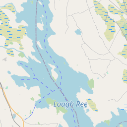
Based on data in OpenStreetMap, here is a list of townlands in the Electoral Division / ED / District Electoral Division of Templetogher.
Templetogher est dans le Comté
Templetogher is not matched up to Logainm.ie yet.
Carte
Il est situé à 53° 40' 13" N, 8° 37' 49" W.


Leaflet | Map data © OpenStreetMap contributors
Superficie
Templetogher a une superficie de 24,7 km² / 6,113,2 acres / 9,6 miles carrés.
Townlands
Il y a 23 townlands connus dans , soit 100% de la superficie de .
- Beagh 643 A, 1 R, 16 P
- Brierfort 356 A, 2 R, 30 P
- Carrowneany 235 A, 3 R, 27 P
- Carrowroe 198 A, 2 R, 25 P
- Cartron East 36 A, 1 R, 13 P
- Cartron West 44 A, 3 R, 29 P
- Cloonmaghaura 683 A, 2 R, 9 P
- Coothagh 101 A, 2 R, 14 P
- Croaghill 458 A, 3 R, 32 P
- Curragh East 52 A, 3 R, 17 P
- Flaskagh More 649 A, 1 R, 34 P
- Gortduff 144 A, 0 R, 6 P
- Kildaree 370 A, 3 R, 24 P
- Kilmore 443 A, 0 R, 11 P
- Kilnalag 213 A, 1 R, 5 P
- Knockaunnageena 133 A, 2 R, 12 P
- Lisrivis 448 A, 2 R, 21 P
- Parkbaun 50 A, 3 R, 10 P
- Pollarassa 136 A, 3 R, 7 P
- Polleagh North 112 A, 0 R, 21 P
- Polleagh South 137 A, 0 R, 8 P
- Pollremon 346 A, 0 R, 38 P
- Pollynoon 114 A, 1 R, 7 P
 OpenStreetMap
Templetogher a été ajouté à OpenStreetMap le 19 Déc 2016 par Boggedy.
- View
- Edit

 JOSM
JOSM iD
iD