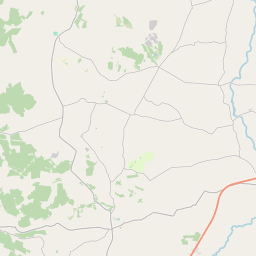
Based on data in OpenStreetMap, here is a list of townlands in the Electoral Division / ED / District Electoral Division of Newtownsandes.
Newtownsandes est dans le Comté
Newtownsandes is not matched up to Logainm.ie yet.
Carte
Il est situé à 52° 28' 50" N, 9° 21' 45" W.


Leaflet | Map data © OpenStreetMap contributors
Superficie
Newtownsandes a une superficie de 37,3 km² / 9,209,3 acres / 14,4 miles carrés.
Townlands
Il y a 18 townlands connus dans , soit 100% de la superficie de .
- Ahalahana 773 A, 1 R, 26 P
- Beennanaspuck 580 A, 1 R, 7 P
- Cloonbrane 316 A, 0 R, 5 P
- Cloonprohus 250 A, 1 R, 16 P
- Cuss 149 A, 1 R, 33 P
- Dromurher 197 A, 0 R, 33 P
- Gortdromagownagh 1199 A, 0 R, 14 P
- Gortdromascallahy 746 A, 3 R, 31 P
- Kealid 882 A, 1 R, 22 P
- Kilbaha Middle 239 A, 2 R, 34 P
- Kilbaha North 438 A, 0 R, 7 P
- Kilbaha South 257 A, 2 R, 21 P
- Kilbaha West 154 A, 1 R, 31 P
- Lissaniska 752 A, 3 R, 10 P
- Moyvane North 454 A, 3 R, 9 P
- Moyvane South 431 A, 1 R, 31 P
- Murher 582 A, 1 R, 34 P
- Toberatooreen 802 A, 2 R, 33 P
 OpenStreetMap
Newtownsandes a été ajouté à OpenStreetMap le 7 Jan 2017 par Teester.
- View
- Edit

 JOSM
JOSM iD
iD