Based on data in OpenStreetMap, here is a list of townlands in Kilbeacon.
Kilbeacon fait partie des baronnies de Knocktopher.
Kilbeacon fait partie des comtés de Kilkenny.
Kilbeacon est sur Logainm.ie: Kilbeacon.
Carte
Il est situé à 52° 23' 24" N, 7° 9' 19" W.
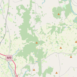
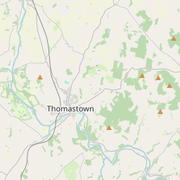
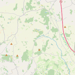
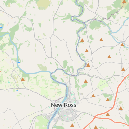
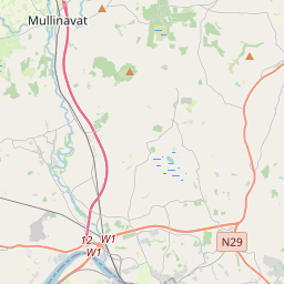
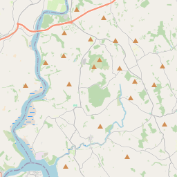
Leaflet | Map data © OpenStreetMap contributors
Superficie
Kilbeacon a une superficie de 13,8 km² / 3,404,7 acres / 5,3 miles carrés.
Townlands
There are 11 townlands that we know about in Kilbeacon. This represents 100% of all the area in Kilbeacon.
- Baile an Ghabhann Beag (see Smithstown (Baile an Ghabhann Beag) , Paroisse civile Kilbeacon, Baronnie de Knocktopher, Comté Kilkenny)
- Baile an Inneonaigh Thiar (see Ballynoony West (Baile an Inneonaigh Thiar) , Paroisse civile Kilbeacon, Baronnie de Knocktopher, Comté Kilkenny)
- Baile an Inneonaigh Thoir (see Ballynoony East (Baile an Inneonaigh Thoir) , Paroisse civile Kilbeacon, Baronnie de Knocktopher, Comté Kilkenny)
- Baile Bhaitín (see Ballyvatheen (Baile Bhaitín) , Paroisse civile Kilbeacon, Baronnie de Knocktopher, Comté Kilkenny)
- An Baile Loiscthe (see Ballylusky (An Baile Loiscthe) , Paroisse civile Kilbeacon, Baronnie de Knocktopher, Comté Kilkenny)
- Ballylusky (An Baile Loiscthe) , Paroisse civile Kilbeacon, Baronnie de Knocktopher, Comté Kilkenny 326 A, 2 R, 9 P
- Ballynoony East (Baile an Inneonaigh Thoir) , Paroisse civile Kilbeacon, Baronnie de Knocktopher, Comté Kilkenny 410 A, 2 R, 35 P
- Ballynoony West (Baile an Inneonaigh Thiar) , Paroisse civile Kilbeacon, Baronnie de Knocktopher, Comté Kilkenny 1329 A, 2 R, 24 P
- Ballyvatheen (Baile Bhaitín) , Paroisse civile Kilbeacon, Baronnie de Knocktopher, Comté Kilkenny 104 A, 3 R, 14 P
- Coolanimod North (Cúil an Adhmaid Thuaidh) , Paroisse civile Kilbeacon, Baronnie de Knocktopher, Comté Kilkenny 166 A, 1 R, 22 P
- Coolanimod South (Cúil an Adhmaid Theas) , Paroisse civile Kilbeacon, Baronnie de Knocktopher, Comté Kilkenny 113 A, 3 R, 3 P
- Cúil an Adhmaid Theas (see Coolanimod South (Cúil an Adhmaid Theas) , Paroisse civile Kilbeacon, Baronnie de Knocktopher, Comté Kilkenny)
- Cúil an Adhmaid Thuaidh (see Coolanimod North (Cúil an Adhmaid Thuaidh) , Paroisse civile Kilbeacon, Baronnie de Knocktopher, Comté Kilkenny)
- Cúirt an Mhoinséalaigh (see Manselscourt (Cúirt an Mhoinséalaigh) , Paroisse civile Kilbeacon, Baronnie de Knocktopher, Comté Kilkenny)
- Earlsrath (Ráth an Iarla) , Paroisse civile Kilbeacon, Baronnie de Knocktopher, Comté Kilkenny 142 A, 2 R, 0 P
- East Ballynoony (see Ballynoony East (Baile an Inneonaigh Thoir) , Paroisse civile Kilbeacon, Baronnie de Knocktopher, Comté Kilkenny)
- An Garrán Darach (see Garrandarragh (An Garrán Darach) , Paroisse civile Kilbeacon, Baronnie de Knocktopher, Comté Kilkenny)
- Garrandarragh (An Garrán Darach) , Paroisse civile Kilbeacon, Baronnie de Knocktopher, Comté Kilkenny 376 A, 3 R, 35 P
- Manselscourt (Cúirt an Mhoinséalaigh) , Paroisse civile Kilbeacon, Baronnie de Knocktopher, Comté Kilkenny 228 A, 3 R, 16 P
- Mullinavat, Paroisse civile Kilbeacon, Baronnie de Knocktopher, Comté Kilkenny 32 A, 0 R, 9 P
- North Coolanimod (see Coolanimod North (Cúil an Adhmaid Thuaidh) , Paroisse civile Kilbeacon, Baronnie de Knocktopher, Comté Kilkenny)
- Ráth an Iarla (see Earlsrath (Ráth an Iarla) , Paroisse civile Kilbeacon, Baronnie de Knocktopher, Comté Kilkenny)
- Smithstown (Baile an Ghabhann Beag) , Paroisse civile Kilbeacon, Baronnie de Knocktopher, Comté Kilkenny 172 A, 1 R, 14 P
- South Coolanimod (see Coolanimod South (Cúil an Adhmaid Theas) , Paroisse civile Kilbeacon, Baronnie de Knocktopher, Comté Kilkenny)
- West Ballynoony (see Ballynoony West (Baile an Inneonaigh Thiar) , Paroisse civile Kilbeacon, Baronnie de Knocktopher, Comté Kilkenny)
 OpenStreetMap
Kilbeacon a été ajouté à OpenStreetMap le 16 Oct 2015 par murtcostello.
- View
- Edit