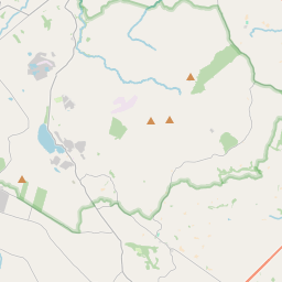
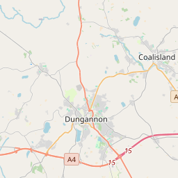
Based on data in OpenStreetMap, here is a list of townlands in Derryloran (Derry portion).
Derryloran (Derry portion) fait partie des baronnies de Loughinsholin.
Derryloran (Derry portion) fait partie des comtés de Londonderry.
Derryloran (Derry portion) is not matched up to Logainm.ie yet.
Carte
Il est situé à 54° 39' 10" N, 6° 42' 2" W.


Leaflet | Map data © OpenStreetMap contributors
Superficie
Derryloran (Derry portion) a une superficie de 9,9 km² / 2,442,3 acres / 3,8 miles carrés.
Townlands
There are 10 townlands that we know about in Derryloran (Derry portion). This represents 95,0% of all the area in Derryloran (Derry portion).
- Baile-an-locháin (see Ballyloughan (Baile-an-locháin) , Paroisse civile Derryloran (Derry portion), Baronnie de Loughinsholin, Comté Londonderry)
- Baile-fir-laith (see Ballyforlea (Baile-fir-laith) , Paroisse civile Derryloran (Derry portion), Baronnie de Loughinsholin, Comté Londonderry)
- Ballyforlea (Baile-fir-laith) , Paroisse civile Derryloran (Derry portion), Baronnie de Loughinsholin, Comté Londonderry 102 A, 1 R, 20 P
- Ballyloughan (Baile-an-locháin) , Paroisse civile Derryloran (Derry portion), Baronnie de Loughinsholin, Comté Londonderry 553 A, 0 R, 21 P
- Cloch-og (see Cloghog (Cloch-og) , Paroisse civile Derryloran (Derry portion), Baronnie de Loughinsholin, Comté Londonderry)
- Cloghog (Cloch-og) , Paroisse civile Derryloran (Derry portion), Baronnie de Loughinsholin, Comté Londonderry 281 A, 0 R, 29 P
- Coille-bhearna (see Killybearn (Coille-bhearna) , Paroisse civile Derryloran (Derry portion), Baronnie de Loughinsholin, Comté Londonderry)
- Daire-cromadh (see Derrycrummy (Daire-cromadh) , Paroisse civile Derryloran (Derry portion), Baronnie de Loughinsholin, Comté Londonderry)
- Derrycrummy (Daire-cromadh) , Paroisse civile Derryloran (Derry portion), Baronnie de Loughinsholin, Comté Londonderry 216 A, 0 R, 6 P
- Druim-rot (see Drumrot (Druim-rot) , Paroisse civile Derryloran (Derry portion), Baronnie de Loughinsholin, Comté Londonderry)
- Drumrot (Druim-rot) , Paroisse civile Derryloran (Derry portion), Baronnie de Loughinsholin, Comté Londonderry 47 A, 0 R, 30 P
- Dun-meann (see Dunman (Dun-meann) , Paroisse civile Derryloran (Derry portion), Baronnie de Loughinsholin, Comté Londonderry)
- Dunman (Dun-meann) , Paroisse civile Derryloran (Derry portion), Baronnie de Loughinsholin, Comté Londonderry 112 A, 0 R, 7 P
- Killybearn (Coille-bhearna) , Paroisse civile Derryloran (Derry portion), Baronnie de Loughinsholin, Comté Londonderry 417 A, 3 R, 7 P
- Tamhleacht-mor (see Tamlaghtmore (Tamhleacht-mor) , Paroisse civile Derryloran (Derry portion), Baronnie de Loughinsholin, Comté Londonderry)
- Tamlaghtmore (Tamhleacht-mor) , Paroisse civile Derryloran (Derry portion), Baronnie de Loughinsholin, Comté Londonderry 229 A, 0 R, 0 P
- Terressan (Tir-easa) , Paroisse civile Derryloran (Derry portion), Baronnie de Loughinsholin, Comté Londonderry 186 A, 3 R, 29 P
- Tir-easa (see Terressan (Tir-easa) , Paroisse civile Derryloran (Derry portion), Baronnie de Loughinsholin, Comté Londonderry)
- Tullyboy, Paroisse civile Derryloran (Derry portion), Baronnie de Loughinsholin, Comté Londonderry 173 A, 2 R, 15 P
 OpenStreetMap
Derryloran (Derry portion) a été ajouté à OpenStreetMap le 3 Aoû 2016 par Stephen_Co_Antrim.
- View
- Edit

 JOSM
JOSM iD
iD