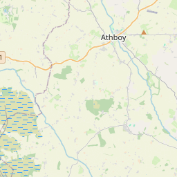
Based on data in OpenStreetMap, here is a list of townlands in the Electoral Division / ED / District Electoral Division of Ballymahon.
Ballymahon est dans le Comté
Ballymahon is not matched up to Logainm.ie yet.
Carte
Il est situé à 53° 34' 10" N, 7° 46' 23" W.


Leaflet | Map data © OpenStreetMap contributors
Superficie
Ballymahon a une superficie de 32,7 km² / 8,089,7 acres / 12,6 miles carrés.
Townlands
Il y a 29 townlands connus dans , soit 100% de la superficie de .
- Agharanagh 178 A, 2 R, 5 P
- Ballybranigan 282 A, 3 R, 8 P
- Ballymahon 279 A, 1 R, 3 P
- Ballymulvey 452 A, 2 R, 37 P
- Barry (Taghshinny Civil Parish) 242 A, 1 R, 0 P
- Cartronboy 119 A, 0 R, 26 P
- Castlecore 267 A, 1 R, 9 P
- Cloonard 403 A, 0 R, 23 P
- Cloonkeen 303 A, 2 R, 36 P
- Cornacarta 163 A, 1 R, 26 P
- Creevaghbeg 456 A, 3 R, 32 P
- Creevaghmore (Forgney Civil Parish) 386 A, 0 R, 11 P
- Creevagh More (Noughaval Civil Parish) 164 A, 0 R, 33 P
- Daroge 413 A, 1 R, 0 P
- Drinan 392 A, 0 R, 16 P
- Garrynagh 95 A, 2 R, 19 P
- Glebe 57 A, 3 R, 5 P
- Knappoge 209 A, 2 R, 14 P
- Laragh 157 A, 2 R, 5 P
- Lislom 188 A, 1 R, 35 P
- Lissanisky 54 A, 1 R, 19 P
- Moneyfad 69 A, 3 R, 34 P
- Moygh 356 A, 3 R, 35 P
- Mullawornia 241 A, 0 R, 31 P
- Rathmore 854 A, 1 R, 18 P
- Shrule 54 A, 1 R, 12 P
- Tipper 81 A, 0 R, 38 P
- Tirlickeen 852 A, 2 R, 25 P
- Toome 310 A, 2 R, 19 P
 OpenStreetMap
Ballymahon a été ajouté à OpenStreetMap le 18 Jul 2013 par PaddyMatthews.
- View
- Edit

 JOSM
JOSM iD
iD