Based on data in OpenStreetMap, here is a list of townlands in the Electoral Division / ED / District Electoral Division of The Rock.
The Rock est dans le Comté
The Rock is not matched up to Logainm.ie yet.
Carte
Il est situé à 54° 35' 45" N, 6° 50' 58" W.
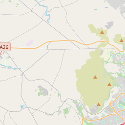

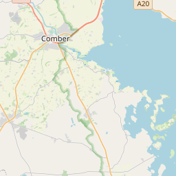
Leaflet | Map data © OpenStreetMap contributors
Superficie
The Rock a une superficie de 19,8 km² / 4,890,7 acres / 7,6 miles carrés.
Townlands
Il y a 21 townlands connus dans , soit 100% de la superficie de .
- Allen 152 A, 1 R, 4 P
- Annaghquin 142 A, 0 R, 9 P
- Bardahessiagh 588 A, 1 R, 16 P
- Derrygortanea 252 A, 3 R, 3 P
- Drumballyhugh 214 A, 0 R, 12 P
- Drummillard 174 A, 2 R, 2 P
- Edendoit 349 A, 3 R, 23 P
- Galcussagh 235 A, 2 R, 25 P
- Gortavale 361 A, 2 R, 3 P
- Kiltyclay 273 A, 2 R, 18 P
- Knockavaddy 235 A, 2 R, 33 P
- Moneygaragh 170 A, 0 R, 5 P
- Moree 260 A, 1 R, 23 P
- Moynagh 110 A, 2 R, 25 P
- Mullynure 161 A, 2 R, 38 P
- Oughterard 154 A, 1 R, 11 P
- Sessiagh (Scott) 178 A, 1 R, 34 P
- Skenahergny 257 A, 0 R, 39 P
- Tirnaskea 148 A, 1 R, 2 P
- Tolvin 174 A, 0 R, 7 P
- Tullyodonnell 295 A, 0 R, 8 P
 OpenStreetMap
The Rock a été ajouté à OpenStreetMap le 4 Mar 2021 par b-unicycling.
- View
- Edit