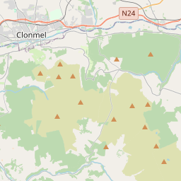
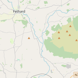
Based on data in OpenStreetMap, here is a list of townlands in Dysert.
Dysert fait partie des baronnies de Upperthird.
Dysert fait partie des comtés de Waterford.
Dysert est sur Logainm.ie: Dysert.
Carte
Il est situé à 52° 20' 36" N, 7° 32' 20" W.


Leaflet | Map data © OpenStreetMap contributors
Superficie
Dysert a une superficie de 35,2 km² / 8,706,5 acres / 13,6 miles carrés.
Townlands
There are 20 townlands that we know about in Dysert. This represents 100,0% of all the area in Dysert.
- Ardmore (see Windgap or Ardmore (Bearna na Gaoithe) , Paroisse civile Dysert, Baronnie de Upperthird, Comté Waterford)
- Baile an Teampaill (see Churchtown (Baile an Teampaill) , Paroisse civile Dysert, Baronnie de Upperthird, Comté Waterford)
- Baile na Cloiche (see Ballyclohy (Baile na Cloiche) , Paroisse civile Dysert, Baronnie de Upperthird, Comté Waterford)
- Ballindysert (Buaile an Dísirt) , Paroisse civile Dysert, Baronnie de Upperthird, Comté Waterford 939 A, 0 R, 23 P
- Ballyclohy (Baile na Cloiche) , Paroisse civile Dysert, Baronnie de Upperthird, Comté Waterford 454 A, 3 R, 26 P
- Bearna na Gaoithe (see Windgap or Ardmore (Bearna na Gaoithe) , Paroisse civile Dysert, Baronnie de Upperthird, Comté Waterford)
- Boola, Paroisse civile Dysert, Baronnie de Upperthird, Comté Waterford 651 A, 3 R, 10 P
- Buaile an Dísirt (see Ballindysert (Buaile an Dísirt) , Paroisse civile Dysert, Baronnie de Upperthird, Comté Waterford)
- Carraig Eidhneach (see Corragina (Carraig Eidhneach) , Paroisse civile Dysert, Baronnie de Upperthird, Comté Waterford)
- Churchtown (Baile an Teampaill) , Paroisse civile Dysert, Baronnie de Upperthird, Comté Waterford 401 A, 3 R, 15 P
- Churchtownhill (Cnoc Bhaile an Teampaill) , Paroisse civile Dysert, Baronnie de Upperthird, Comté Waterford 270 A, 2 R, 28 P
- Cill Drúchtáin (see Kildroughtaun (Cill Drúchtáin) , Paroisse civile Dysert, Baronnie de Upperthird, Comté Waterford)
- Cnoc Bhaile an Teampaill (see Churchtownhill (Cnoc Bhaile an Teampaill) , Paroisse civile Dysert, Baronnie de Upperthird, Comté Waterford)
- An Coimín (see Common (An Coimín) , Paroisse civile Dysert, Baronnie de Upperthird, Comté Waterford)
- Common (An Coimín) , Paroisse civile Dysert, Baronnie de Upperthird, Comté Waterford 1 A, 1 R, 13 P
- Coolishal, Paroisse civile Dysert, Baronnie de Upperthird, Comté Waterford 660 A, 0 R, 5 P
- Coolnamuck Demesne (Diméin Chúil na Muice) , Paroisse civile Dysert, Baronnie de Upperthird, Comté Waterford 336 A, 1 R, 6 P
- Coolnamuck East (Cúil na Muice Thoir) , Paroisse civile Dysert, Baronnie de Upperthird, Comté Waterford 316 A, 1 R, 11 P
- Coolnamuck West (Cúil na Muice Thiar) , Paroisse civile Dysert, Baronnie de Upperthird, Comté Waterford 260 A, 3 R, 11 P
- Corragina (Carraig Eidhneach) , Paroisse civile Dysert, Baronnie de Upperthird, Comté Waterford 54 A, 3 R, 36 P
- Cúil na Muice Thiar (see Coolnamuck West (Cúil na Muice Thiar) , Paroisse civile Dysert, Baronnie de Upperthird, Comté Waterford)
- Cúil na Muice Thoir (see Coolnamuck East (Cúil na Muice Thoir) , Paroisse civile Dysert, Baronnie de Upperthird, Comté Waterford)
- Diméin Chúil na Muice (see Coolnamuck Demesne (Diméin Chúil na Muice) , Paroisse civile Dysert, Baronnie de Upperthird, Comté Waterford)
- East Coolnamuck (see Coolnamuck East (Cúil na Muice Thoir) , Paroisse civile Dysert, Baronnie de Upperthird, Comté Waterford)
- An Gleann Íochtarach (see Glen Lower (An Gleann Íochtarach) , Paroisse civile Dysert, Baronnie de Upperthird, Comté Waterford)
- An Gleann Uachtarach (see Glen Upper (An Gleann Uachtarach) , Paroisse civile Dysert, Baronnie de Upperthird, Comté Waterford)
- Glen Lower (An Gleann Íochtarach) , Paroisse civile Dysert, Baronnie de Upperthird, Comté Waterford 625 A, 1 R, 10 P
- Glen Upper (An Gleann Uachtarach) , Paroisse civile Dysert, Baronnie de Upperthird, Comté Waterford 803 A, 0 R, 24 P
- Gurteen Lower, Paroisse civile Dysert, Baronnie de Upperthird, Comté Waterford 409 A, 0 R, 0 P
- Gurteen Upper, Paroisse civile Dysert, Baronnie de Upperthird, Comté Waterford 1530 A, 1 R, 22 P
- Kildroughtaun (Cill Drúchtáin) , Paroisse civile Dysert, Baronnie de Upperthird, Comté Waterford 187 A, 3 R, 6 P
- Landscape, Paroisse civile Dysert, Baronnie de Upperthird, Comté Waterford 138 A, 2 R, 10 P
- Lower Glen (see Glen Lower (An Gleann Íochtarach) , Paroisse civile Dysert, Baronnie de Upperthird, Comté Waterford)
- Lower Gurteen (see Gurteen Lower, Paroisse civile Dysert, Baronnie de Upperthird, Comté Waterford)
- An Scairt Liath (see Scartlea (An Scairt Liath) , Paroisse civile Dysert, Baronnie de Upperthird, Comté Waterford)
- Scartlea (An Scairt Liath) , Paroisse civile Dysert, Baronnie de Upperthird, Comté Waterford 216 A, 2 R, 31 P
- Toor (An Tuar) , Paroisse civile Dysert, Baronnie de Upperthird, Comté Waterford 365 A, 2 R, 32 P
- An Tuar (see Toor (An Tuar) , Paroisse civile Dysert, Baronnie de Upperthird, Comté Waterford)
- Upper Glen (see Glen Upper (An Gleann Uachtarach) , Paroisse civile Dysert, Baronnie de Upperthird, Comté Waterford)
- Upper Gurteen (see Gurteen Upper, Paroisse civile Dysert, Baronnie de Upperthird, Comté Waterford)
- West Coolnamuck (see Coolnamuck West (Cúil na Muice Thiar) , Paroisse civile Dysert, Baronnie de Upperthird, Comté Waterford)
- Windgap or Ardmore (Bearna na Gaoithe) , Paroisse civile Dysert, Baronnie de Upperthird, Comté Waterford 77 A, 1 R, 18 P
 OpenStreetMap
Dysert a été ajouté à OpenStreetMap le 25 Jul 2016 par Teester.
- View
- Edit

 JOSM
JOSM iD
iD