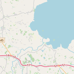
Based on data in OpenStreetMap, here is a list of townlands in the Electoral Division / ED / District Electoral Division of Loughgall.
Loughgall is in Co.
Loughgall is not matched up to Logainm.ie yet.
Léarscáil
It is located at 54° 25' 9" N, 6° 35' 6" W.


Leaflet | Map data © OpenStreetMap contributors
Achar
Loughgall has an area of 21.6 km² / 5,340.3 acres / 8.3 square miles.
Ceannbhailte
There are 21 townlands that we know about in . This represents 100% of all the area in .
- Eanach Creamha 220 A, 0 R, 26 P
- Baile ua gcathasaigh 206 A, 0 R, 36 P
- Baile cnuic 172 A, 0 R, 21 P
- Baile mhic Aithirne 261 A, 1 R, 16 P
- Caisleán Rátha 258 A, 2 R, 8 P
- Cois-eanach 294 A, 3 R, 21 P
- Currach 306 A, 3 R, 38 P
- Doire craobh 447 A, 2 R, 13 P
- Bun an Locháin 259 A, 0 R, 20 P
- Druim Airt 91 A, 1 R, 24 P
- Druim Airt 88 A, 1 R, 14 P
- Droim Thairbh 209 A, 1 R, 38 P
- Fearann na gcraobhach 286 A, 1 R, 39 P
- Grange Lower 904 A, 1 R, 16 P
- Grange Upper 64 A, 3 R, 14 P
- Grianan 193 A, 3 R, 15 P
- Cionn Con 112 A, 1 R, 19 P
- Leath-baile Eaglaise 224 A, 2 R, 14 P
- Lios an aonaigh 235 A, 3 R, 0 P
- Loch gCál 136 A, 0 R, 19 P
- An Tulaigh Mhór 365 A, 2 R, 17 P
 OpenStreetMap
Loughgall was added to OpenStreetMap on 23 Feabh 2021 by b-unicycling.
- View
- Edit

 JOSM
JOSM iD
iD